|
search place name
|
||
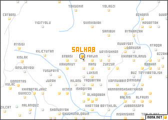
Salḩab (Idlib, Syria)Salḩab is a town in the Idlib region of Syria. An overview map of the region around Salḩab is displayed below.
regional and 3d topo map of Salḩab, Syria ::
Salḩab airports ::
The nearest airport is LTK - Latakia Bassel Al Assad Intl, located 69.7 km south west of Salḩab.
Other airports nearby include ALP - Aleppo Intl (88.0 km east), ADA - Adana Incirlik Ab (138.2 km north west), ADA - Adana (144.1 km north west), GZT - Gaziantep Oguzeli (152.7 km north east), Nearby towns ::
Al Ajrash (0.0km north) //
Kuyubaşı (1.5km west) //
Farjīn (1.5km east) //
‘Ayn Khinzīrah (1.9km south) //
Dirrīyah (2.4km north east) //
Mar‘ū (2.4km south east) //
Najīb (2.4km south east) //
Luksīn (2.4km south east) //
Erbaşı (3.0km west) //
Hatyah (3.7km south) //
Dayr ‘Uthmān (3.0km east) //
Kāwur Kūy (3.5km south west) //
Luksīn (4.0km south) //
Jurayjirīyah (4.5km east) //
Būblīn (4.5km east) //
Judaydah (5.6km south) //
Dayr Ishmān (4.6km east) //
Miland (5.8km south) //
Zurzūr (4.9km east) //
Ya‘qūbīyah (5.8km south) //
Qanāyah (6.3km south east) //
Az Zawf (5.8km south west) //
Isḩāqīyah (7.4km south) //
Sivrikavak (7.6km north) //
‘Āmūd (6.3km east) //
Sarıbük (7.2km north east) //
Yūsufayn (6.8km south west) //
Kitrīn (8.0km south) //
Kılıçtutan (7.1km west) //
[all distances 'as the bird flies' and approximate] 
Disclaimer :: Information on this page comes without warranty of any kind |
||
|
Where is Salḩab? Elevation and coordinates ::
Latitude (lat): 35°58'0"N Longitude (lon): 36°17'0"E
Elevation (approx.): 416m (map arrows pan, magnifying glasses zoom) |
||
|
Visiting Salḩab? Hotel/Accommodation ::
Book a hotel in Salḩab Travel Guide ::
Buy a travel guide for Syria rental cars ::
car rental offers GPS waypoint ::
download a GPX waypoint (PoI) of Salḩab for your GPS receiver
|
||