|
search place name
|
||
Tall Ḩusayn (Ḩimş, Syria)Tall Ḩusayn is a town in the Ḩimş region of Syria. An overview map of the region around Tall Ḩusayn is displayed below.
regional and 3d topo map of Tall Ḩusayn, Syria ::

Tall Ḩusayn airports ::
The nearest airport is LTK - Latakia Bassel Al Assad Intl, located 85.3 km north west of Tall Ḩusayn.
Other airports nearby include BEY - Beirut Rafic Hariri Intl (124.8 km south west), DAM - Damascus Intl (144.0 km south), PMS - Palmyra (182.6 km east), ALP - Aleppo Intl (183.1 km north east), Nearby towns ::
An Nāşirīyah (1.9km south) //
An Nā‘ūrah (2.4km south east) //
Umm Jāmi‘ (2.4km south east) //
Umm Ḩāratayn (3.0km east) //
‘Aynātā (4.0km north) //
Bsās (3.6km north west) //
‘Anaz (4.8km north west) //
Şayyādah (4.8km north west) //
‘Arīḑah (4.8km south west) //
Nā‘isīyah (4.8km south east) //
Shumayyisah (4.6km west) //
Sindiyānah al Gharbīyah (4.6km west) //
Tall Jirdawn (4.9km east) //
Qizil Khāşş (4.9km east) //
‘Aynātā (5.8km north) //
Mcheïrefé see Mushayrifat al Jabal (5.8km south) //
Mushayrifat al Jabal (5.8km south) //
Şafşāfah (5.9km north east) //
Qīqānīyah (5.9km north east) //
At Tallah (6.3km north west) //
‘Ayn at Tīnah ash Sharqīyah (5.9km south east) //
Su‘ūd (5.9km south west) //
Ḩadīdah (5.9km south east) //
Rajablīyah (6.3km north east) //
Tall aş Şafā (6.1km east) //
Rayḩānīyah (6.1km east) //
Mashtá Ḩammūd (7.4km south) //
Jiwā al ‘Arab (7.4km south) //
Qumayrī (6.4km west) //
[all distances 'as the bird flies' and approximate] 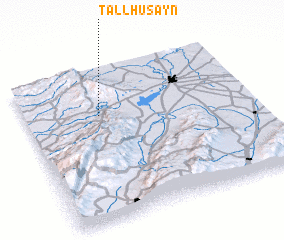 Places with similar names to Tall Ḩusayn, Syria ::
// Dahlhausen (DE)
// Dahlhausen (DE)
// Dahlhausen (DE)
// Dahlhausen (DE)
// Dahlhausen (DE)
// Dahlhausen (DE)
// Dahlhausen (DE)
// Dahlhausen (DE)
// Dalhausen (DE)
// Dahlhausen (DE)
Disclaimer :: Information on this page comes without warranty of any kind |
||
|
Where is Tall Ḩusayn? Elevation and coordinates ::
Latitude (lat): 34°42'0"N Longitude (lon): 36°20'0"E
Elevation (approx.): 263m (map arrows pan, magnifying glasses zoom) |
||
|
Visiting Tall Ḩusayn? Hotel/Accommodation ::
Book a hotel in Tall Ḩusayn Travel Guide ::
Buy a travel guide for Syria rental cars ::
car rental offers GPS waypoint ::
download a GPX waypoint (PoI) of Tall Ḩusayn for your GPS receiver
|
||