|
search place name
|
||
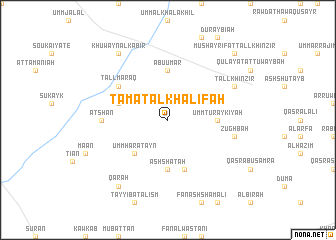
Ţāmat al Khalīfah (Ḩamāh, Syria)Ţāmat al Khalīfah is a town in the Ḩamāh region of Syria. An overview map of the region around Ţāmat al Khalīfah is displayed below.
regional and 3d topo map of Ţāmat al Khalīfah, Syria ::
Ţāmat al Khalīfah airports ::
The nearest airport is LTK - Latakia Bassel Al Assad Intl, located 84.9 km west of Ţāmat al Khalīfah.
Other airports nearby include ALP - Aleppo Intl (91.9 km north), PMS - Palmyra (160.9 km south east), GZT - Gaziantep Oguzeli (179.8 km north), BEY - Beirut Rafic Hariri Intl (216.9 km south west), Nearby towns ::
Umm Ḩāratayn (4.8km south west) //
Qubaybāt Abū al Hudá (4.8km south west) //
Ash Sha‘ţah (5.6km south) //
Abū ‘Umar (5.6km north) //
Umm Turaykīyah (4.5km east) //
Al Ḩamdānīyah (4.9km west) //
Junaynah (5.8km south) //
Ţulaysīyah (5.8km south) //
Tall Maraq (5.9km north west) //
‘Aţshān (6.0km west) //
Zughbah (6.3km east) //
Tall Khinzīr (7.1km north east) //
Qarāḩ (8.7km south west) //
Khuwayn al Kabīr (8.7km north west) //
Mushayrifat Tall Khinzīr (9.6km north east) //
[all distances 'as the bird flies' and approximate] 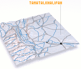 Places with similar names to Ţāmat al Khalīfah, Syria :: Disclaimer :: Information on this page comes without warranty of any kind |
||
|
Where is Ţāmat al Khalīfah? Elevation and coordinates ::
Latitude (lat): 35°24'0"N Longitude (lon): 36°53'0"E
Elevation (approx.): 367m (map arrows pan, magnifying glasses zoom) |
||
|
Visiting Ţāmat al Khalīfah? Hotel/Accommodation ::
Book a hotel in Ţāmat al Khalīfah Travel Guide ::
Buy a travel guide for Syria rental cars ::
car rental offers GPS waypoint ::
download a GPX waypoint (PoI) of Ţāmat al Khalīfah for your GPS receiver
|
||