|
search place name
|
||
Tuwayzān (Ar Raqqah, Syria)Tuwayzān is a town in the Ar Raqqah region of Syria. An overview map of the region around Tuwayzān is displayed below.
regional and 3d topo map of Tuwayzān, Syria ::

Tuwayzān airports ::
The nearest airport is ALP - Aleppo Intl, located 98.4 km north west of Tuwayzān.
Other airports nearby include PMS - Palmyra (140.0 km south), GZT - Gaziantep Oguzeli (142.0 km north west), DEZ - Deire Zor Deir Zzor (186.9 km east), Nearby towns ::
Rumayḩān (2.0km south west) //
Mutaḩayyir (2.9km south east) //
Biʼr Mulayḩān (2.9km east) //
Shatnah (2.9km east) //
Al ‘Ajar (3.9km west) //
Khirbat aş Şa‘b (6.2km north) //
Al Muḩaddad (6.8km north east) //
Rumthān (7.9km south) //
Al Quşūr (7.1km east) //
Al Bawşī (8.3km south west) //
Ḩannā Şafar (8.8km north west) //
Ḩusayn al Mukhallaf (8.2km south west) //
Ghayth (8.7km north east) //
Al Muwaylah (9.0km south west) //
[all distances 'as the bird flies' and approximate] 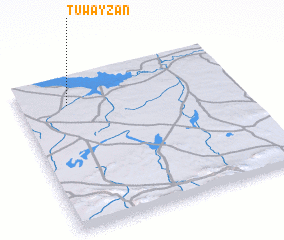
Disclaimer :: Information on this page comes without warranty of any kind |
||
|
Where is Tuwayzān? Elevation and coordinates ::
Latitude (lat): 35°49'0"N Longitude (lon): 38°13'10"E
Elevation (approx.): 344m (map arrows pan, magnifying glasses zoom) |
||
|
Visiting Tuwayzān? Hotel/Accommodation ::
Book a hotel in Tuwayzān Travel Guide ::
Buy a travel guide for Syria rental cars ::
car rental offers GPS waypoint ::
download a GPX waypoint (PoI) of Tuwayzān for your GPS receiver
|
||