|
search place name
|
||
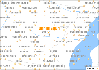
Umm Arsoûm (Ḩalab, Syria)Umm Arsoûm is a town in the Ḩalab region of Syria. An overview map of the region around Umm Arsoûm is displayed below.
regional and 3d topo map of Umm Arsoûm, Syria ::
Umm Arsoûm airports ::
The nearest airport is ALP - Aleppo Intl, located 66.8 km west of Umm Arsoûm.
Other airports nearby include GZT - Gaziantep Oguzeli (93.7 km north west), PMS - Palmyra (185.0 km south), Nearby towns ::
Abū Jakkah (0.0km north) //
Şafā (1.5km west) //
Salmá (2.4km north east) //
Rasm al Aḩmar (2.4km south east) //
Ḩarb Şaghīrah (4.0km north) //
Khafsah (4.0km north) //
Khirbat Shihāb (4.0km north) //
Al Ḩamūd (4.0km south) //
Rasm al Bukhār (4.0km south) //
Ţabbārat Kalash (5.6km south) //
‘Arīḑīyah (4.9km west) //
‘Ayn Shāţir (4.9km east) //
Rasm al Hirmil aş Şaghīr (4.9km east) //
Milqāfah (5.1km east) //
Khirbat Salām (5.3km east) //
Adīm (5.8km north west) //
Ma‘raḑah al Kabīrah (6.3km north east) //
Ţannūzah (5.8km south west) //
Mashrafat ‘Abd al Karīm (5.8km north east) //
Khafsah (5.8km north east) //
Wādī al Malqāfah (5.8km south east) //
Tall Tutun (6.3km south west) //
Shīḩah (7.6km north) //
Shu‘ayb (7.6km north) //
Al Aqra‘ (7.6km south) //
Al ‘Ashīnī (6.3km west) //
Khafīyat al Ḩumr (7.6km north) //
Rujm Khamīs ash Sharqī (7.6km south) //
Qaşr Sallūm (7.1km south west) //
[all distances 'as the bird flies' and approximate] 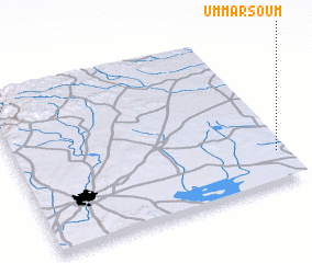 Places with similar names to Umm Arsoûm, Syria ::
// Umm ar Rizam (LY)
Disclaimer :: Information on this page comes without warranty of any kind |
||
|
Where is Umm Arsoûm? Elevation and coordinates ::
Latitude (lat): 36°12'0"N Longitude (lon): 37°58'0"E
Elevation (approx.): 394m (map arrows pan, magnifying glasses zoom) |
||
|
Visiting Umm Arsoûm? Hotel/Accommodation ::
Book a hotel in Umm Arsoûm Travel Guide ::
Buy a travel guide for Syria rental cars ::
car rental offers GPS waypoint ::
download a GPX waypoint (PoI) of Umm Arsoûm for your GPS receiver
|
||