|
search place name
|
||
Umm Ḩurayzah (Ḩamāh, Syria)Umm Ḩurayzah is a town in the Ḩamāh region of Syria. An overview map of the region around Umm Ḩurayzah is displayed below.
regional and 3d topo map of Umm Ḩurayzah, Syria ::

Umm Ḩurayzah airports ::
The nearest airport is ALP - Aleppo Intl, located 107.1 km north of Umm Ḩurayzah.
Other airports nearby include LTK - Latakia Bassel Al Assad Intl (112.6 km west), PMS - Palmyra (128.1 km south east), GZT - Gaziantep Oguzeli (194.1 km north), DAM - Damascus Intl (209.1 km south), Nearby towns ::
Kubaybāt (2.4km south west) //
Tall ‘Abd al ‘Azīz (3.0km west) //
Shuhayb (4.4km south west) //
Tall al Ghār (4.9km east) //
Abū Khanādiq al Qiblī (5.8km north) //
Al Judaydah (5.8km north) //
Ḩarfūshīyah (5.9km south east) //
Fawrā (5.4km east) //
Khunayfis ad Dūsah (5.9km south west) //
Şabūrah (6.6km south east) //
Madabah (7.4km north) //
Abū Samrah (7.4km north) //
Ruḩayyah (6.3km west) //
Jubb Ruzayq (7.2km north east) //
Abū Marw (8.0km north) //
Şabbūrah (8.0km south) //
Jassīn (8.0km south) //
Al Buwayḑ (8.7km north west) //
Qal‘at ar Ruḩayyah (8.2km north west) //
[all distances 'as the bird flies' and approximate] 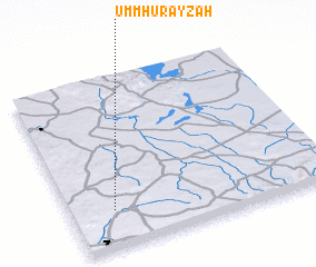 Places with similar names to Umm Ḩurayzah, Syria ::
Disclaimer :: Information on this page comes without warranty of any kind |
||
|
Where is Umm Ḩurayzah? Elevation and coordinates ::
Latitude (lat): 35°13'0"N Longitude (lon): 37°10'0"E
Elevation (approx.): 445m (map arrows pan, magnifying glasses zoom) |
||
|
Visiting Umm Ḩurayzah? Hotel/Accommodation ::
Book a hotel in Umm Ḩurayzah Travel Guide ::
Buy a travel guide for Syria rental cars ::
car rental offers GPS waypoint ::
download a GPX waypoint (PoI) of Umm Ḩurayzah for your GPS receiver
|
||