|
search place name
|
||
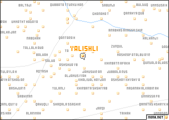
Yalishlī (Ḩalab, Syria)Yalishlī is a town in the Ḩalab region of Syria. An overview map of the region around Yalishlī is displayed below.
regional and 3d topo map of Yalishlī, Syria ::
Yalishlī airports ::
The nearest airport is GZT - Gaziantep Oguzeli, located 46.3 km north west of Yalishlī.
Other airports nearby include ALP - Aleppo Intl (67.3 km south west), MLX - Malatya Erhac (205.7 km north), LTK - Latakia Bassel Al Assad Intl (211.1 km south west), Nearby towns ::
Al Ḩumrān (1.9km north) //
Ad Dandānīyah (1.9km south) //
Umm al Julūd (2.4km north east) //
Tall ‘Alī (2.4km north west) //
Umm ‘Adasat al Fārāt (3.0km east) //
Kīrbishallī (3.0km west) //
Ash Shu‘ayb (3.5km south west) //
Jāmūs Wīrān (4.0km south) //
Al Jāmūsīyah (4.9km south) //
Dālī Faʼr (4.8km south east) //
Qanţarah (4.8km north west) //
Mīrzā Shahīd (4.8km north west) //
Mīr Khān (4.5km west) //
Khālid al Hayjān (5.8km south) //
Şaydīyah (5.8km south) //
Ţāshlī Huyūk (4.8km north west) //
Shatal Wīrān (4.8km south west) //
Tall al Ḩajar (5.4km west) //
Ballī (6.3km south east) //
Al Ḩajar al Abyaḑ (6.3km south west) //
Salwá (6.1km west) //
Khirbat Nafakh (6.2km east) //
Zunqul (6.2km east) //
Qarah Ţāshlī (7.6km north) //
Khirbat ash Shiyāb (7.6km south) //
Wuraydah (7.6km south) //
Ala Bāsh (7.1km north east) //
Jubb al ‘Arūs (7.0km south east) //
Būzlījah al Gharbīyah (7.0km south west) //
[all distances 'as the bird flies' and approximate]  Places with similar names to Yalishlī, Syria ::
Disclaimer :: Information on this page comes without warranty of any kind |
||
|
Where is Yalishlī? Elevation and coordinates ::
Latitude (lat): 36°36'0"N Longitude (lon): 37°46'0"E
Elevation (approx.): 489m (map arrows pan, magnifying glasses zoom) |
||
|
Visiting Yalishlī? Hotel/Accommodation ::
Book a hotel in Yalishlī Travel Guide ::
Buy a travel guide for Syria rental cars ::
car rental offers GPS waypoint ::
download a GPX waypoint (PoI) of Yalishlī for your GPS receiver
|
||