|
search place name
|
||
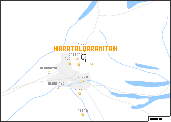
Ḩārat al Qarāmitah (Oman)Ḩārat al Qarāmitah is a town in Oman. An overview map of the region around Ḩārat al Qarāmitah is displayed below.
regional and 3d topo map of Ḩārat al Qarāmitah, Oman ::
Ḩārat al Qarāmitah airports ::
The nearest airport is FJR - Fujeirah Fujairah Intl, located 110.1 km north east of Ḩārat al Qarāmitah.
Other airports nearby include AUH - Abu Dhabi Intl (115.4 km west), DXB - Dubai Intl (117.9 km north), SHJ - Sharjah Intl (121.6 km north), AZI - Abu Dhabi Bateen (134.7 km west), Nearby towns ::
Aş Şa‘arah (1.3km south east) //
Ḩārat al Qāḑī (1.5km south west) //
Qaţţārah (1.8km west) //
Ḩamāsah (2.0km south) //
Al Buraymī (2.3km west) //
Hillī (3.1km north) //
Al Qīmī (3.2km west) //
Mas‘ūdī (3.8km north west) //
Al ‘Ayn (4.4km south) //
Al Mu‘taraḑ (5.7km south west) //
Al ‘Ayn (7.2km south) //
Al Muwayqi‘ī (7.7km west) //
Al Muwayqi‘ī (8.3km south west) //
[all distances 'as the bird flies' and approximate] 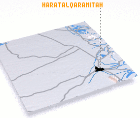 Places with similar names to Ḩārat al Qarāmitah, Oman :: Disclaimer :: Information on this page comes without warranty of any kind |
||
|
Where is Ḩārat al Qarāmitah? Elevation and coordinates ::
Latitude (lat): 24°15'21"N Longitude (lon): 55°46'20"E
Elevation (approx.): 286m (map arrows pan, magnifying glasses zoom) |
||
|
Visiting Ḩārat al Qarāmitah? Hotel/Accommodation ::
Book a hotel in Ḩārat al Qarāmitah Travel Guide ::
Buy a travel guide for Oman rental cars ::
car rental offers GPS waypoint ::
download a GPX waypoint (PoI) of Ḩārat al Qarāmitah for your GPS receiver
|
||