|
search place name
|
||
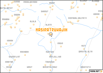
Maşīrat Ruwājiḩ (Oman)Maşīrat Ruwājiḩ is a town in Oman. An overview map of the region around Maşīrat Ruwājiḩ is displayed below.
regional and 3d topo map of Maşīrat Ruwājiḩ, Oman ::
Maşīrat Ruwājiḩ airports ::
The nearest airport is MCT - Muscat Seeb Intl, located 87.5 km north east of Maşīrat Ruwājiḩ.
Nearby towns ::
Salūt (1.6km north west) //
Al Abābah (2.1km south) //
Kamfārah (2.1km north) //
Qurayyah (2.4km north east) //
Al Qāshār (2.6km north) //
Shurayjah (2.7km north west) //
Al ‘Aqar (3.2km north) //
Al ‘Ayn (3.3km north) //
Ḩayl Yaman (3.7km north east) //
Dubīyah (3.6km north east) //
Sayq (4.1km north west) //
Rasīn (4.8km south east) //
Duwaykhīlah (5.5km north east) //
Mu‘aydin (6.7km south) //
Al ‘Alāʼ (7.5km north west) //
Bībān (7.6km north east) //
Banī Ḩabīb (7.6km north west) //
Shanuţ (8.4km north) //
Manākhīr (8.2km north east) //
Ḩayl al Liwāʼ (8.7km south) //
Al Ghaba (8.3km north east) //
Sīrqān (8.5km north east) //
[all distances 'as the bird flies' and approximate] 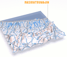 Places with similar names to Maşīrat Ruwājiḩ, Oman :: Disclaimer :: Information on this page comes without warranty of any kind |
||
|
Where is Maşīrat Ruwājiḩ? Elevation and coordinates ::
Latitude (lat): 23°2'38"N Longitude (lon): 57°40'13"E
Elevation (approx.): 1237m (map arrows pan, magnifying glasses zoom) |
||
|
Visiting Maşīrat Ruwājiḩ? Hotel/Accommodation ::
Book a hotel in Maşīrat Ruwājiḩ Travel Guide ::
Buy a travel guide for Oman rental cars ::
car rental offers GPS waypoint ::
download a GPX waypoint (PoI) of Maşīrat Ruwājiḩ for your GPS receiver
|
||