|
search place name
|
||
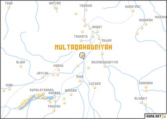
Multaqā Ḩadrīyah (Oman)Multaqā Ḩadrīyah is a town in Oman. An overview map of the region around Multaqā Ḩadrīyah is displayed below.
regional and 3d topo map of Multaqā Ḩadrīyah, Oman ::
Multaqā Ḩadrīyah airports ::
The nearest airport is MCT - Muscat Seeb Intl, located 29.6 km north east of Multaqā Ḩadrīyah.
Other airports nearby include FJR - Fujeirah Fujairah Intl (262.8 km north west), Nearby towns ::
Multaqā ‘Alwiyāh (1.8km south west) //
Sarūr (2.1km south east) //
Al Farfārah (3.0km north) //
Qarn (3.3km north) //
Bidbid (3.4km north east) //
Thumayd (4.3km north) //
Naf‘ah (4.0km east) //
Khawbī (4.2km north east) //
Ridāʼ (4.8km south) //
Mazra‘ Khuşayyin (4.6km east) //
Qurţā (4.9km north east) //
Waghlah (5.5km north) //
Al Mulayyanah (5.7km north east) //
Karkū (5.6km south west) //
Nujūm (5.9km north east) //
Ḩamīm (6.3km north) //
Luzugh (6.7km south) //
Badī (6.4km south west) //
Amqāt (7.0km north east) //
Qu‘ayd (7.2km north) //
Fanjah (7.7km north) //
Faljāt (7.2km south west) //
Ḩassās (8.3km south) //
Muḑrah (9.7km south west) //
Khūbār (10.3km south west) //
Ḩājir Rākah (11.6km south west) //
[all distances 'as the bird flies' and approximate]  Places with similar names to Multaqā Ḩadrīyah, Oman :: Disclaimer :: Information on this page comes without warranty of any kind |
||
|
Where is Multaqā Ḩadrīyah? Elevation and coordinates ::
Latitude (lat): 23°23'13"N Longitude (lon): 58°6'1"E
Elevation (approx.): 250m (map arrows pan, magnifying glasses zoom) |
||
|
Visiting Multaqā Ḩadrīyah? Hotel/Accommodation ::
Book a hotel in Multaqā Ḩadrīyah Travel Guide ::
Buy a travel guide for Oman rental cars ::
car rental offers GPS waypoint ::
download a GPX waypoint (PoI) of Multaqā Ḩadrīyah for your GPS receiver
|
||