|
search place name
|
||
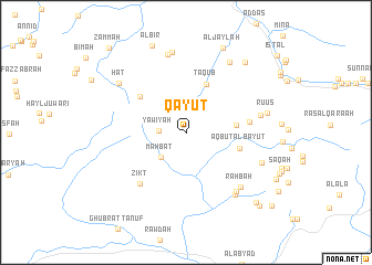
Qayūt (Oman)Qayūt is a town in Oman. An overview map of the region around Qayūt is displayed below.
regional and 3d topo map of Qayūt, Oman ::
Qayūt airports ::
The nearest airport is MCT - Muscat Seeb Intl, located 97.0 km north east of Qayūt.
Other airports nearby include FJR - Fujeirah Fujairah Intl (247.6 km north west), Nearby towns ::
Yawīyah (2.5km west) //
Ḩalḩāl (3.0km north east) //
Mahbaţ (3.4km south west) //
Muşayrat Shurayqīyīn (4.7km east) //
Taqub (5.2km north) //
Aqbut al Bayūt (5.2km east) //
Khawr Zammah (5.6km north west) //
Al Khuţaym (6.0km east) //
Zikt (6.7km south west) //
Qarr Shamīs (7.2km east) //
Qāshah (7.6km south east) //
Raḩbah (7.6km south east) //
Sumaysim (8.0km north) //
Ḩayl (7.8km south east) //
Al ‘Ayr (8.2km north) //
Salaylah (7.7km south east) //
Al Hijīr (8.1km north east) //
Hāţ (7.9km north west) //
Ruʼūs (7.8km east) //
Al Jaylah (9.2km north) //
As Suwayb (9.0km north east) //
Al Biʼr (9.3km north) //
Al Ma‘qul (9.7km south east) //
Al Khadirah (10.1km south east) //
Al Ḩuwīr (10.9km south east) //
Zammah (11.1km north west) //
[all distances 'as the bird flies' and approximate] 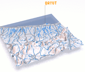 Places with similar names to Qayūt, Oman ::
Disclaimer :: Information on this page comes without warranty of any kind |
||
|
Where is Qayūt? Elevation and coordinates ::
Latitude (lat): 23°8'26"N Longitude (lon): 57°28'19"E
Elevation (approx.): 1995m (map arrows pan, magnifying glasses zoom) |
||
|
Visiting Qayūt? Hotel/Accommodation ::
Book a hotel in Qayūt Travel Guide ::
Buy a travel guide for Oman rental cars ::
car rental offers GPS waypoint ::
download a GPX waypoint (PoI) of Qayūt for your GPS receiver
|
||