|
search place name
|
||
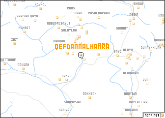
Qef Dann al Ḩamrāʼ (Oman)Qef Dann al Ḩamrāʼ is a town in Oman. An overview map of the region around Qef Dann al Ḩamrāʼ is displayed below.
regional and 3d topo map of Qef Dann al Ḩamrāʼ, Oman ::
Qef Dann al Ḩamrāʼ airports ::
The nearest airport is MCT - Muscat Seeb Intl, located 93.9 km north east of Qef Dann al Ḩamrāʼ.
Nearby towns ::
Dann al Ḩamrāʼ (0.4km east) //
Al Ḩuwīr (2.4km north west) //
Kahf al Ḩumayr (3.1km north west) //
Al Khadirah (3.4km west) //
Al Khutaymī (3.7km north) //
Banī Ḩabīb (3.5km east) //
Al Ma‘qul (3.8km north west) //
Al Gharīr Sufālah (4.3km north) //
Al Gharīr ‘Alāyah (4.7km north) //
Saqah (4.8km north) //
Al Khusayţ (5.1km north) //
Asāqat Bilarb (5.2km north) //
Al ‘Alāʼ (4.9km north east) //
Lālī Laynah (5.9km north) //
Kamah (5.8km south west) //
Raḩbah (5.8km north west) //
Ḩayl (5.9km north west) //
Qāshah (5.9km north west) //
Al Ghalā‘il (6.4km north) //
Salaylah (6.3km north west) //
Al Abyaḑ (6.7km south west) //
Rukhḑayn (7.0km north) //
Hulaylāt (7.9km north) //
Sayq (7.4km east) //
Rakhbah (8.9km south) //
Aqbut al Bayūt (8.7km north west) //
[all distances 'as the bird flies' and approximate] 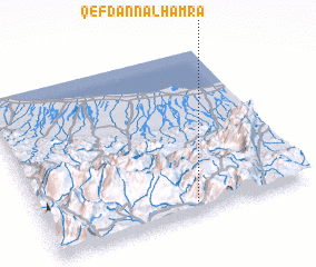 Places with similar names to Qef Dann al Ḩamrāʼ, Oman :: Disclaimer :: Information on this page comes without warranty of any kind |
||
|
Where is Qef Dann al Ḩamrāʼ? Elevation and coordinates ::
Latitude (lat): 23°3'44"N Longitude (lon): 57°34'9"E
Elevation (approx.): 1766m (map arrows pan, magnifying glasses zoom) |
||
|
Visiting Qef Dann al Ḩamrāʼ? Hotel/Accommodation ::
Book a hotel in Qef Dann al Ḩamrāʼ Travel Guide ::
Buy a travel guide for Oman rental cars ::
car rental offers GPS waypoint ::
download a GPX waypoint (PoI) of Qef Dann al Ḩamrāʼ for your GPS receiver
|
||