|
search place name
|
||
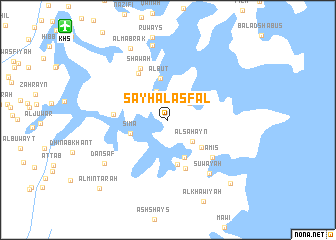
Sayḩ al Asfal (Musandam, Oman)Sayḩ al Asfal is a town in the Musandam region of Oman. An overview map of the region around Sayḩ al Asfal is displayed below.
regional and 3d topo map of Sayḩ al Asfal, Oman ::
Sayḩ al Asfal airports ::
The nearest airport is KHS - Khasab, located 14.6 km north west of Sayḩ al Asfal.
Other airports nearby include RKT - Ras Al Khaimah Intl (65.5 km south west), FJR - Fujeirah Fujairah Intl (107.0 km south), SHJ - Sharjah Intl (117.3 km south west), BND - Bandar Abbass Intl (126.4 km north), Nearby towns ::
Manşal (2.9km north east) //
Al Birak (3.4km north) //
Al Sahayn (3.4km south east) //
Sīmā (4.0km west) //
Birkat Khaldīyah (4.5km south) //
Al Būt (4.7km north) //
Sall al A‘lá (4.6km south east) //
Raʼs as Salām (5.1km south) //
Al Fiduk (5.7km south) //
Ghubn Ḩamad (5.5km west) //
Sahb an Nūn (6.0km north west) //
‘Amīs (6.2km south east) //
Shawah (6.4km north west) //
Suwayah (7.3km south east) //
Al Ḩabalayn (8.4km north) //
Danşaf (8.0km south west) //
Al Mabrak (8.8km north west) //
Al Khaţmah (9.5km south east) //
Al Mintarah (10.3km south west) //
[all distances 'as the bird flies' and approximate] 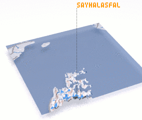 Places with similar names to Sayḩ al Asfal, Oman :: Disclaimer :: Information on this page comes without warranty of any kind |
||
|
Where is Sayḩ al Asfal? Elevation and coordinates ::
Latitude (lat): 26°4'39"N Longitude (lon): 56°20'36"E
Elevation (approx.): 304m (map arrows pan, magnifying glasses zoom) |
||
|
Visiting Sayḩ al Asfal? Hotel/Accommodation ::
Book a hotel in Sayḩ al Asfal Travel Guide ::
Buy a travel guide for Oman rental cars ::
car rental offers GPS waypoint ::
download a GPX waypoint (PoI) of Sayḩ al Asfal for your GPS receiver
|
||