|
search place name
|
||
Aderibigbe (Oyo, Nigeria)Aderibigbe is a town in the Oyo region of Nigeria. An overview map of the region around Aderibigbe is displayed below.
regional and 3d topo map of Aderibigbe, Nigeria ::

Aderibigbe airports ::
The nearest airport is IBA - Ibadan, located 36.6 km south of Aderibigbe.
Other airports nearby include ILR - Ilorin (101.3 km north east), LOS - Lagos Murtala Muhammed (142.3 km south west), AKR - Akure (155.7 km east), COO - Cotonou Cadjehoun (228.6 km south west), Nearby towns ::
Akinola (0.5km north) //
Bello (1.0km north) //
Adio (1.0km north) //
Iware (1.5km south) //
Arafejojo (1.6km north) //
Ajingode (1.7km north east) //
Oyekan (1.9km north east) //
Elesan (2.0km north) //
Lagun (2.1km north) //
Akande (2.4km north) //
Imeleke (2.6km north east) //
Adekunle (2.6km east) //
Amodu (2.8km north) //
Ojerinde (3.2km south west) //
Ajagba (3.3km north east) //
Ona (3.3km east) //
Panu (3.4km north) //
Molade (3.4km south west) //
Asalu Obose (3.5km north east) //
Osa (3.6km east) //
Dakeja (3.6km south west) //
Dapo (3.7km north) //
Alabata (3.7km east) //
Ajitose (3.8km north east) //
Alayin (3.8km south east) //
Idowu Oko (3.8km south east) //
Abudu (4.0km north) //
Amosun (4.2km south) //
Elebolo (4.2km north) //
[all distances 'as the bird flies' and approximate] 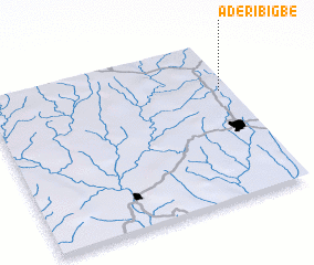 Places with similar names to Aderibigbe, Nigeria ::
// Aderibigbe (NG)
Disclaimer :: Information on this page comes without warranty of any kind |
||
|
Where is Aderibigbe? Elevation and coordinates ::
Latitude (lat): 7°41'35"N Longitude (lon): 3°57'46"E
Elevation (approx.): 363m (map arrows pan, magnifying glasses zoom) |
||
|
Visiting Aderibigbe? Hotel/Accommodation ::
Book a hotel in Aderibigbe Travel Guide ::
Buy a travel guide for Nigeria rental cars ::
car rental offers GPS waypoint ::
download a GPX waypoint (PoI) of Aderibigbe for your GPS receiver
|
||