|
search place name
|
||
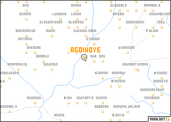
Ago Iwoye (Gongola, Nigeria)Ago Iwoye is a town in the Gongola region of Nigeria. An overview map of the region around Ago Iwoye is displayed below.
regional and 3d topo map of Ago Iwoye, Nigeria ::
Ago Iwoye airports ::
The nearest airport is IBA - Ibadan, located 46.1 km north of Ago Iwoye.
Other airports nearby include LOS - Lagos Murtala Muhammed (77.7 km south west), AKR - Akure (156.4 km east), ILR - Ilorin (176.7 km north), COO - Cotonou Cadjehoun (181.7 km west), Nearby towns ::
Awa (1.8km east) //
Sabo (2.6km north west) //
Oru (3.7km east) //
Eyinodo (4.1km north east) //
Odo Ekerin (4.1km north west) //
Iganran (5.2km south east) //
Ajegunle Awa (5.6km north) //
Araromi Logi (7.4km north) //
Alebiosu (7.6km north) //
Ijokodo (7.6km north) //
Sigunsin (7.6km west) //
Imope (7.8km south east) //
Aparaki (8.2km south east) //
Abata (8.3km north west) //
Oke Erigba (8.3km north west) //
Ipari Isale (9.2km south east) //
Ipari Oke (9.2km south east) //
Awori (9.2km north west) //
Gbogiri (10.4km north east) //
Ita-Egba (10.4km north east) //
Elegunmesan (10.4km north west) //
[all distances 'as the bird flies' and approximate] 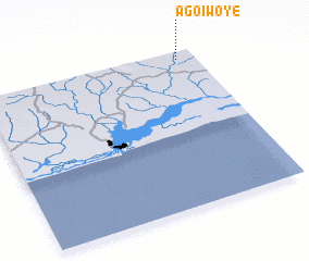 Places with similar names to Ago Iwoye, Nigeria ::
Disclaimer :: Information on this page comes without warranty of any kind |
||
|
Where is Ago Iwoye? Elevation and coordinates ::
Latitude (lat): 6°57'0"N Longitude (lon): 3°55'0"E
Elevation (approx.): 54m (map arrows pan, magnifying glasses zoom) |
||
|
Visiting Ago Iwoye? Hotel/Accommodation ::
Book a hotel in Ago Iwoye Travel Guide ::
Buy a travel guide for Nigeria rental cars ::
car rental offers GPS waypoint ::
download a GPX waypoint (PoI) of Ago Iwoye for your GPS receiver
|
||