|
search place name
|
||
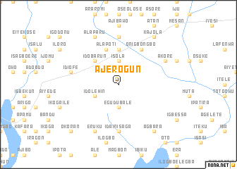
Ajerogun (Gongola, Nigeria)Ajerogun is a town in the Gongola region of Nigeria. An overview map of the region around Ajerogun is displayed below.
regional and 3d topo map of Ajerogun, Nigeria ::
Ajerogun airports ::
The nearest airport is LOS - Lagos Murtala Muhammed, located 30.0 km east of Ajerogun.
Other airports nearby include COO - Cotonou Cadjehoun (77.8 km west), IBA - Ibadan (134.0 km north east), LFW - Lome Gnassingbe Eyadema Intl (203.9 km west), ILR - Ilorin (259.9 km north east), Nearby towns ::
Alagogo (1.9km north) //
Ketu Adieowe (2.6km north east) //
Egudu Bale (3.7km south) //
Isola (3.7km north) //
Idolehin (4.1km south west) //
Owoye (4.1km north east) //
Idobarun (5.2km north west) //
Idiroko (5.6km north) //
Alapoti (5.9km north) //
Onigbongbo (6.7km north east) //
Idain Isaga (7.4km south) //
Ajegunle (7.4km north) //
Ogunleke (7.4km north) //
Idi Ofe (7.6km west) //
Eruku (8.3km south west) //
Alaparu (8.3km north west) //
Akore (8.2km north east) //
Agbara (9.2km south east) //
Kajola (9.2km north east) //
Okoran (10.4km south west) //
[all distances 'as the bird flies' and approximate] 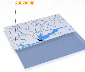 Places with similar names to Ajerogun, Nigeria ::
// Ajeregun (NG)
Disclaimer :: Information on this page comes without warranty of any kind |
||
|
Where is Ajerogun? Elevation and coordinates ::
Latitude (lat): 6°35'0"N Longitude (lon): 3°3'0"E
Elevation (approx.): 37m (map arrows pan, magnifying glasses zoom) |
||
|
Visiting Ajerogun? Hotel/Accommodation ::
Book a hotel in Ajerogun Travel Guide ::
Buy a travel guide for Nigeria rental cars ::
car rental offers GPS waypoint ::
download a GPX waypoint (PoI) of Ajerogun for your GPS receiver
|
||