|
search place name
|
||
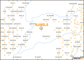
Ajibola (Gongola, Nigeria)Ajibola is a town in the Gongola region of Nigeria. An overview map of the region around Ajibola is displayed below.
regional and 3d topo map of Ajibola, Nigeria ::
Ajibola airports ::
The nearest airport is IBA - Ibadan, located 42.5 km south east of Ajibola.
Other airports nearby include LOS - Lagos Murtala Muhammed (111.2 km south), ILR - Ilorin (138.1 km north east), AKR - Akure (186.8 km east), COO - Cotonou Cadjehoun (189.6 km south west), Nearby towns ::
Onikankan (4.1km north west) //
Onikanga (4.1km south east) //
Batake (4.1km north east) //
Gbada (5.5km east) //
Alaka (5.5km east) //
Adesiyan (5.5km east) //
Abimba (5.8km west) //
Alaraba (6.7km north east) //
Idiya (6.6km north east) //
Idiogun (7.3km east) //
Dijo (7.3km east) //
Eleiyele (7.6km west) //
Busari (7.6km west) //
Idiamu (7.6km east) //
Okolo (8.2km south west) //
Akore (8.2km south east) //
Onifade (8.2km south east) //
Aba Oke (8.2km north east) //
Abemo (9.2km south west) //
Elere (10.4km south west) //
[all distances 'as the bird flies' and approximate]  Places with similar names to Ajibola, Nigeria ::
// ‘Ajab Allāh (SD)
// Agibela (NG)
Disclaimer :: Information on this page comes without warranty of any kind |
||
|
Where is Ajibola? Elevation and coordinates ::
Latitude (lat): 7°32'0"N Longitude (lon): 3°38'0"E
Elevation (approx.): 160m (map arrows pan, magnifying glasses zoom) |
||
|
Visiting Ajibola? Hotel/Accommodation ::
Book a hotel in Ajibola Travel Guide ::
Buy a travel guide for Nigeria rental cars ::
car rental offers GPS waypoint ::
download a GPX waypoint (PoI) of Ajibola for your GPS receiver
|
||