|
search place name
|
||
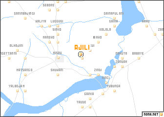
Ajili (Gongola, Nigeria)Ajili is a town in the Gongola region of Nigeria. An overview map of the region around Ajili is displayed below.
regional and 3d topo map of Ajili, Nigeria ::
Ajili airports ::
The nearest airport is KAN - Kano Mallam Aminu Intl, located 231.7 km west of Ajili.
Other airports nearby include JOS - Jos Yakubu Gowon (258.7 km south west), Nearby towns ::
Gargawa (0.0km north) //
Dunkui (2.6km north east) //
Shabal (4.1km south east) //
Ibawo (5.2km north east) //
Zindi (5.2km south east) //
Misau (5.3km west) //
Aftaka (6.6km north west) //
Bangarati (6.6km south west) //
Shuwari (6.6km south west) //
Daba (7.5km east) //
Kalala (7.8km north east) //
Gagalun (7.8km north east) //
Sirko (7.8km north west) //
Kinci (7.8km south east) //
Marewo (8.2km north west) //
Bawari (9.2km north west) //
Luggudi (9.2km north west) //
Kari (9.3km south east) //
Gaina (10.4km north east) //
Yubunga (10.4km south east) //
Dallari (10.4km north west) //
[all distances 'as the bird flies' and approximate]  Places with similar names to Ajili, Nigeria ::
Disclaimer :: Information on this page comes without warranty of any kind |
||
|
Where is Ajili? Elevation and coordinates ::
Latitude (lat): 11°19'0"N Longitude (lon): 10°31'0"E
Elevation (approx.): 427m (map arrows pan, magnifying glasses zoom) |
||
|
Visiting Ajili? Hotel/Accommodation ::
Book a hotel in Ajili Travel Guide ::
Buy a travel guide for Nigeria rental cars ::
car rental offers GPS waypoint ::
download a GPX waypoint (PoI) of Ajili for your GPS receiver
|
||