|
search place name
|
||
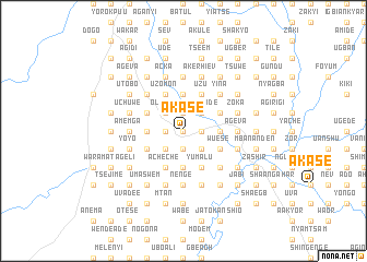
Akase (Gongola, Nigeria)Akase is a town in the Gongola region of Nigeria. An overview map of the region around Akase is displayed below.
regional and 3d topo map of Akase, Nigeria ::
Akase airports ::
The nearest airport is MDI - Makurdi, located 63.2 km north of Akase.
Other airports nearby include ENU - Enugu (134.4 km south west), BPC - Bamenda (208.8 km south east), ABV - Abuja Nnamdi Azikiwe Intl (253.2 km north west), BFX - Bafoussam (263.8 km south east), Nearby towns ::
Akuamande (0.0km north) //
Zengem (0.0km north) //
Poor (0.0km north) //
Gungun (1.8km west) //
Toho (1.9km south) //
Torto (1.9km south) //
Tsegha (1.9km south) //
Tyo Kyaa (1.9km south) //
Atim (1.9km south) //
Anacha (1.9km south) //
Shamo (1.9km south) //
Deke (1.9km north) //
Tiadum (1.8km east) //
Shanger De (1.9km north) //
Cheren (1.8km east) //
Mtonom (1.8km east) //
Ngbegha (1.8km east) //
Tsetim (1.8km east) //
Yasam (1.8km east) //
Tyogen (2.6km south west) //
Ansule (2.6km south west) //
Ndyor (2.6km south west) //
Agbinda (2.6km south west) //
Veregh (2.6km south west) //
Olokaa (2.6km north west) //
Nahanga (2.6km north west) //
Chur (2.6km south east) //
Ikpam (2.6km south east) //
Hundu (2.6km south east) //
[all distances 'as the bird flies' and approximate] 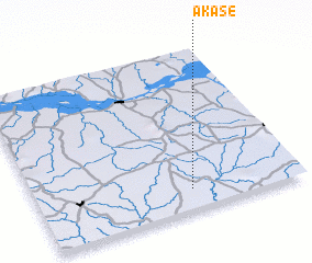 Places with similar names to Akase, Nigeria ::
Disclaimer :: Information on this page comes without warranty of any kind |
||
|
Where is Akase? Elevation and coordinates ::
Latitude (lat): 7°8'0"N Longitude (lon): 8°35'0"E
Elevation (approx.): 119m (map arrows pan, magnifying glasses zoom) |
||
|
Visiting Akase? Hotel/Accommodation ::
Book a hotel in Akase Travel Guide ::
Buy a travel guide for Nigeria rental cars ::
car rental offers GPS waypoint ::
download a GPX waypoint (PoI) of Akase for your GPS receiver
|
||