|
search place name
|
||
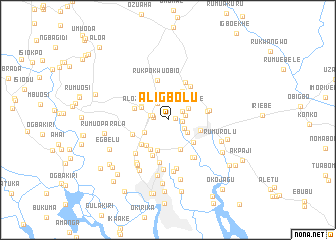
Aligbolu (Nigeria)Aligbolu is a town in Nigeria. An overview map of the region around Aligbolu is displayed below.
regional and 3d topo map of Aligbolu, Nigeria ::
Aligbolu airports ::
The nearest airport is PHC - Port Hartcourt Port Harcourt Intl, located 18.4 km north west of Aligbolu.
Other airports nearby include CBQ - Calabar (148.3 km east), ENU - Enugu (188.2 km north), SSG - Malabo (224.3 km south east), BNI - Benin (224.7 km north west), Nearby towns ::
Aliosu (0.9km east) //
Mpakurche (1.6km east) //
Mikpoku (1.7km west) //
Umuibo (1.8km west) //
Rumunduru (1.9km north east) //
Rumu-Okoro-Odomey (2.0km west) //
Alionahi (2.1km east) //
Umudara (2.1km south east) //
Rumodome (2.2km north west) //
Mgbuesilara (2.5km south east) //
Umuehere (2.6km north east) //
Rumu-Igbo (3.0km south west) //
Ogbodo (3.3km north west) //
Rumu-Aholu (3.3km north west) //
Rumumasi (3.6km south east) //
Rumuofa (3.6km north east) //
Rumuola (3.6km south) //
Rumu-Eme (3.7km south west) //
Obia (3.8km south east) //
Rumukoroshe (3.8km east) //
Rurowolukwo (3.9km south west) //
Alozo (3.9km west) //
Nkpelu (3.9km west) //
Rumu-Ola (3.9km south west) //
Rumu-Chita (4.0km south west) //
Mgbu-Oba (4.3km south west) //
Rurome-rezigbu (4.3km south west) //
Alingbu (4.5km east) //
Rukpokwu-Obio (4.5km north) //
[all distances 'as the bird flies' and approximate]  Places with similar names to Aligbolu, Nigeria ::
Disclaimer :: Information on this page comes without warranty of any kind |
||
|
Where is Aligbolu? Elevation and coordinates ::
Latitude (lat): 4°51'45"N Longitude (lon): 7°0'55"E
Elevation (approx.): 17m (map arrows pan, magnifying glasses zoom) |
||
|
Visiting Aligbolu? Hotel/Accommodation ::
Book a hotel in Aligbolu Travel Guide ::
Buy a travel guide for Nigeria rental cars ::
car rental offers GPS waypoint ::
download a GPX waypoint (PoI) of Aligbolu for your GPS receiver
|
||