|
search place name
|
||
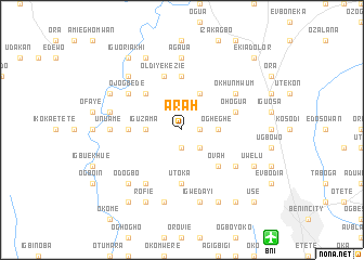
Arah (Gongola, Nigeria)Arah is a town in the Gongola region of Nigeria. An overview map of the region around Arah is displayed below.
regional and 3d topo map of Arah, Nigeria ::
Arah airports ::
The nearest airport is BNI - Benin, located 14.3 km south east of Arah.
Other airports nearby include AKR - Akure (94.8 km north), IBA - Ibadan (199.6 km north west), PHC - Port Hartcourt Port Harcourt Intl (221.8 km south east), Nearby towns ::
Obagia (1.8km east) //
Omi (1.9km south) //
Iguosodin (2.6km south east) //
Iguadolor (3.7km east) //
Ogheghe (3.7km east) //
Iguzama (3.7km west) //
Iguoshodi Nebudin (4.1km north east) //
Ovah (5.2km south east) //
Iguosagban (5.2km north west) //
Iyekezie (5.6km north) //
Adeyanba (5.5km west) //
Okabeghe (5.5km west) //
Utoka (5.6km south) //
Ohogua (5.8km east) //
Iguomo (5.9km north) //
Old Iyekezie (5.9km north) //
Ojogbede (6.7km north west) //
Okhunmwum (6.7km north east) //
Egor (6.7km south east) //
Emianghan (6.7km south west) //
Agaua (7.4km north) //
Unuame (7.4km west) //
Sobetie (7.4km west) //
Evien (7.6km west) //
Igwedayi (7.6km south) //
Iguosula (7.6km south) //
Igoge (7.6km south) //
Asayitan (7.8km north west) //
Odogbo (7.8km south west) //
[all distances 'as the bird flies' and approximate] 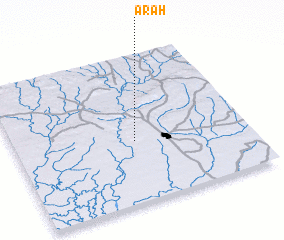 Places with similar names to Arah, Nigeria ::
Disclaimer :: Information on this page comes without warranty of any kind |
||
|
Where is Arah? Elevation and coordinates ::
Latitude (lat): 6°25'0"N Longitude (lon): 5°31'0"E
Elevation (approx.): 115m (map arrows pan, magnifying glasses zoom) |
||
|
Visiting Arah? Hotel/Accommodation ::
Book a hotel in Arah Travel Guide ::
Buy a travel guide for Nigeria rental cars ::
car rental offers GPS waypoint ::
download a GPX waypoint (PoI) of Arah for your GPS receiver
|
||