|
search place name
|
||
Are (Gongola, Nigeria)Are is a town in the Gongola region of Nigeria. An overview map of the region around Are is displayed below.
regional and 3d topo map of Are, Nigeria ::

Are airports ::
The nearest airport is IBA - Ibadan, located 53.9 km north east of Are.
Other airports nearby include LOS - Lagos Murtala Muhammed (63.9 km south west), COO - Cotonou Cadjehoun (154.4 km south west), ILR - Ilorin (180.1 km north east), AKR - Akure (192.3 km east), Nearby towns ::
Balogun (0.0km north) //
Onile Oke (1.8km east) //
Mabon (1.9km north) //
Odo Ijesa (1.9km north) //
Agboran (2.6km south east) //
Eleru (2.6km north west) //
Oluwo (2.6km north west) //
Dendu (3.7km south) //
Ijemo (3.7km south) //
Tejuosho (3.7km east) //
Saromi (3.7km east) //
Daguwa (3.7km north) //
Kogi (3.7km north) //
Akunfori (4.1km south east) //
Agbohun (4.1km south east) //
Isan (4.1km south west) //
Gbaleasun (4.1km north east) //
Oluwo Ake (4.1km north west) //
Ibu Lawe (4.1km south west) //
Aberu Agba (5.2km north west) //
Boruboru (5.5km west) //
Idi Osan (5.5km west) //
Sobande (5.5km east) //
Korede (5.6km north) //
Itoko (5.9km north) //
Elepo (5.9km south) //
Obafemi (5.8km east) //
Paipai (5.8km east) //
Igbo Ilo (6.6km south west) //
[all distances 'as the bird flies' and approximate] 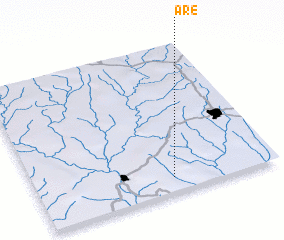 Places with similar names to Are, Nigeria ::
Disclaimer :: Information on this page comes without warranty of any kind |
||
|
Where is Are? Elevation and coordinates ::
Latitude (lat): 7°6'0"N Longitude (lon): 3°34'0"E
Elevation (approx.): 136m (map arrows pan, magnifying glasses zoom) |
||
|
Visiting Are? Hotel/Accommodation ::
Book a hotel in Are Travel Guide ::
Buy a travel guide for Nigeria rental cars ::
car rental offers GPS waypoint ::
download a GPX waypoint (PoI) of Are for your GPS receiver
|
||