|
search place name
|
||
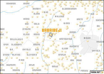
Baba Ibeji (Oyo, Nigeria)Baba Ibeji is a town in the Oyo region of Nigeria. An overview map of the region around Baba Ibeji is displayed below.
regional and 3d topo map of Baba Ibeji, Nigeria ::
Baba Ibeji airports ::
The nearest airport is IBA - Ibadan, located 22.2 km east of Baba Ibeji.
Other airports nearby include LOS - Lagos Murtala Muhammed (104.3 km south west), ILR - Ilorin (139.3 km north east), AKR - Akure (168.7 km east), COO - Cotonou Cadjehoun (192.7 km south west), Nearby towns ::
Amunigun (0.8km south west) //
Alao (1.3km north east) //
Bode Igbo (1.4km south east) //
Boko (1.4km north) //
Igbodi (1.4km north west) //
Ege (1.5km west) //
Balogun (1.5km south) //
Kuye (2.0km north east) //
Baba Agba (2.3km south) //
Siba (2.8km south) //
Atalapa (2.9km north east) //
Omin Adio (3.1km west) //
Apoyin (3.1km west) //
Alape (3.2km north west) //
Olukami (3.2km south) //
Abidogun (3.6km south west) //
Agaloke (3.7km south east) //
Tade (3.8km north west) //
Elere (3.8km south) //
Eresu (4.3km south) //
Anisere (4.4km south west) //
Ologun (4.5km south east) //
Oloko (4.7km south) //
Olugbesan (4.7km south) //
Sinko (4.9km north west) //
Soso (5.0km north east) //
Bukola (5.2km south) //
Agiri (5.2km south west) //
Bola (5.2km south) //
[all distances 'as the bird flies' and approximate]  Places with similar names to Baba Ibeji, Nigeria ::
// Bubí Abajo (PA)
Disclaimer :: Information on this page comes without warranty of any kind |
||
|
Where is Baba Ibeji? Elevation and coordinates ::
Latitude (lat): 7°24'4"N Longitude (lon): 3°46'50"E
Elevation (approx.): 181m (map arrows pan, magnifying glasses zoom) |
||
|
Visiting Baba Ibeji? Hotel/Accommodation ::
Book a hotel in Baba Ibeji Travel Guide ::
Buy a travel guide for Nigeria rental cars ::
car rental offers GPS waypoint ::
download a GPX waypoint (PoI) of Baba Ibeji for your GPS receiver
|
||