|
search place name
|
||
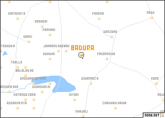
Badura (Gongola, Nigeria)Badura is a town in the Gongola region of Nigeria. An overview map of the region around Badura is displayed below.
regional and 3d topo map of Badura, Nigeria ::
Badura airports ::
The nearest airport is KAN - Kano Mallam Aminu Intl, located 92.9 km south west of Badura.
Other airports nearby include ZND - Zinder (156.4 km north), ZAR - Zaria (225.1 km south west), KAD - Kaduna (286.6 km south west), Nearby towns ::
Guraji (4.1km north west) //
Fagan Kawo (5.4km east) //
Gidan Maza (5.8km south) //
Unguwar Danya (5.7km west) //
Jamaʼar Gade Bawa (5.7km west) //
Duhuwa (7.2km west) //
Dan Zomo (8.2km north east) //
Fankami (9.1km north west) //
Gidan Baki (9.1km south west) //
[all distances 'as the bird flies' and approximate] 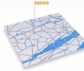 Places with similar names to Badura, Nigeria ::
Disclaimer :: Information on this page comes without warranty of any kind |
||
|
Where is Badura? Elevation and coordinates ::
Latitude (lat): 12°24'0"N Longitude (lon): 9°18'0"E
Elevation (approx.): 376m (map arrows pan, magnifying glasses zoom) |
||
|
Visiting Badura? Hotel/Accommodation ::
Book a hotel in Badura Travel Guide ::
Buy a travel guide for Nigeria rental cars ::
car rental offers GPS waypoint ::
download a GPX waypoint (PoI) of Badura for your GPS receiver
|
||