|
search place name
|
||
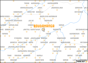
Boudamanga (Gongola, Nigeria)Boudamanga is a town in the Gongola region of Nigeria. An overview map of the region around Boudamanga is displayed below.
regional and 3d topo map of Boudamanga, Nigeria ::
Boudamanga airports ::
The nearest airport is YOL - Yola, located 69.8 km north east of Boudamanga.
Other airports nearby include GOU - Garoua (150.7 km north east), NGE - N'gaoundere Ngaoundere (212.3 km south east), Nearby towns ::
Jauro Saweli (1.8km east) //
Jauro Abdulahi (1.9km north) //
Youro (2.6km south east) //
Kashi Yawo (2.6km south west) //
Mayo Ngalbihi (2.6km south west) //
Babindi (3.7km south) //
Wuro Tukur (3.7km west) //
Saradiam (4.1km north east) //
Dajami (4.1km north west) //
Jauro Joda (5.2km south west) //
Sandoka (5.6km south) //
Wuro Giye (5.5km east) //
Wuro Leke (5.6km north) //
Jauro Alim (5.9km north) //
Sabon Duku (5.9km north) //
Kobake (5.8km west) //
Jaranda (6.7km south east) //
Jauro Joda (6.6km south west) //
Wuro Buka (6.7km north east) //
Julde (6.6km north west) //
Jamtali (7.3km west) //
Konreta (7.6km south) //
Sanda (7.6km east) //
Sarkin Yanma (7.6km north) //
Shebole (7.6km north) //
Boro (7.8km south west) //
Babidi (8.3km south east) //
Sabon Gari (8.2km south east) //
Abdu (8.3km south west) //
[all distances 'as the bird flies' and approximate] 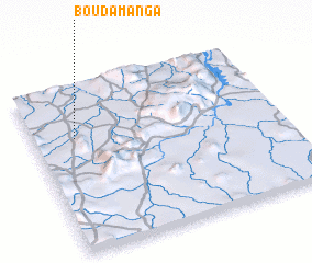 Places with similar names to Boudamanga, Nigeria ::
// Boto Manga (PH)
// Będominek (PL)
// Betamango (MG)
// Betamenaka (MG)
// Betimongo (TD)
// Bodou Manga (TD)
// Batumeang (ID)
// Betumonga (ID)
// Batu Maung (MY)
// Batmang (PK)
Disclaimer :: Information on this page comes without warranty of any kind |
||
|
Where is Boudamanga? Elevation and coordinates ::
Latitude (lat): 8°41'0"N Longitude (lon): 12°10'0"E
Elevation (approx.): 385m (map arrows pan, magnifying glasses zoom) |
||
|
Visiting Boudamanga? Hotel/Accommodation ::
Book a hotel in Boudamanga Travel Guide ::
Buy a travel guide for Nigeria rental cars ::
car rental offers GPS waypoint ::
download a GPX waypoint (PoI) of Boudamanga for your GPS receiver
|
||