|
search place name
|
||
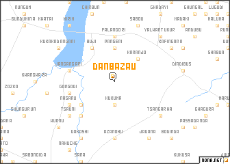
Danbazau (Gongola, Nigeria)Danbazau is a town in the Gongola region of Nigeria. An overview map of the region around Danbazau is displayed below.
regional and 3d topo map of Danbazau, Nigeria ::
Danbazau airports ::
The nearest airport is KAN - Kano Mallam Aminu Intl, located 142.5 km north west of Danbazau.
Other airports nearby include JOS - Jos Yakubu Gowon (223.3 km south west), Nearby towns ::
Kukuma (3.7km south) //
Karanjo (5.2km north east) //
Pangeri (5.6km north) //
Guduba (6.6km south west) //
Buji (6.6km north west) //
Falangori (7.4km north) //
Gargadi (7.5km west) //
Jangargari (7.5km west) //
Dankoshi (7.8km south west) //
Nasaru (8.2km south west) //
Tsauni (9.1km south west) //
Tsangarwa (9.1km south east) //
Yalwar Tukur (10.4km north east) //
[all distances 'as the bird flies' and approximate] 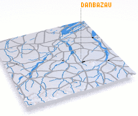 Places with similar names to Danbazau, Nigeria ::
// Danabaşı (TR)
// Tanbossa (BF)
// Danbisoa (CF)
// Tonbesi (ID)
// Dan Bouzou (NE)
// Dan Bouzou (NE)
// Danbazau (NG)
// Dinnbasso (ML)
// Tuanbaosi (CN)
// Ten Bos (BE)
Disclaimer :: Information on this page comes without warranty of any kind |
||
|
Where is Danbazau? Elevation and coordinates ::
Latitude (lat): 11°29'0"N Longitude (lon): 9°42'0"E
Elevation (approx.): 443m (map arrows pan, magnifying glasses zoom) |
||
|
Visiting Danbazau? Hotel/Accommodation ::
Book a hotel in Danbazau Travel Guide ::
Buy a travel guide for Nigeria rental cars ::
car rental offers GPS waypoint ::
download a GPX waypoint (PoI) of Danbazau for your GPS receiver
|
||