|
search place name
|
||
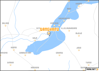
Dangwaru (Gongola, Nigeria)Dangwaru is a town in the Gongola region of Nigeria. An overview map of the region around Dangwaru is displayed below.
regional and 3d topo map of Dangwaru, Nigeria ::
Dangwaru airports ::
The nearest airport is SKO - Sokoto Sadiq Abubakar Iii Intl, located 59.2 km south west of Dangwaru.
Other airports nearby include MFG - Maradi (171.8 km east), THZ - Tahoua (173.4 km north), QUS - Gusau (178.9 km south east), Nearby towns ::
Dole (2.6km north east) //
Giyawa (4.1km north west) //
Kpoyeke (4.1km north east) //
Balla (5.2km north east) //
Daje (5.7km west) //
Illela Dawagare (7.4km east) //
Kagara Rina (7.8km north east) //
Gawasu (8.2km south east) //
[all distances 'as the bird flies' and approximate]  Places with similar names to Dangwaru, Nigeria ::
// Tankwarou (BF)
// Dan Gwari (NE)
// Dan Gwari (NE)
// Diéno Kwara (NE)
// Tangai Wāra (PK)
// Dangwara (NG)
// Dan Gworo (NG)
// Tunkwura (NG)
// Tunkwura (NG)
// Tongowere (FJ)
Disclaimer :: Information on this page comes without warranty of any kind |
||
|
Where is Dangwaru? Elevation and coordinates ::
Latitude (lat): 13°20'0"N Longitude (lon): 5°33'0"E
Elevation (approx.): 264m (map arrows pan, magnifying glasses zoom) |
||
|
Visiting Dangwaru? Hotel/Accommodation ::
Book a hotel in Dangwaru Travel Guide ::
Buy a travel guide for Nigeria rental cars ::
car rental offers GPS waypoint ::
download a GPX waypoint (PoI) of Dangwaru for your GPS receiver
|
||