|
search place name
|
||
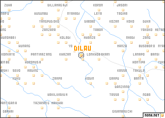
Dilau (Gongola, Nigeria)Dilau is a town in the Gongola region of Nigeria. An overview map of the region around Dilau is displayed below.
regional and 3d topo map of Dilau, Nigeria ::
Dilau airports ::
The nearest airport is YOL - Yola, located 104.3 km north east of Dilau.
Other airports nearby include GOU - Garoua (204.9 km east), NGE - N'gaoundere Ngaoundere (275.9 km south east), Nearby towns ::
Nyaja (0.0km north) //
Kumon (1.9km north) //
Yorro (2.6km north west) //
Lonkwo Bakari (3.7km east) //
Kwazan (3.7km west) //
Mwanze (4.1km north east) //
Danlonkwo (5.2km north west) //
Koladi (5.2km north west) //
Dinyaja Prussa (5.6km north) //
Kodin (5.9km south) //
Donkun (5.9km south) //
Nkwa (5.9km north) //
Tabon (6.7km north east) //
Deso (6.6km north west) //
Dibobo (7.6km north) //
Donkun Tukur (7.8km south east) //
Zampa (7.8km south west) //
Pantilapu (7.8km north west) //
Jauro Mani Nzebe (8.2km north east) //
Dinya (9.2km south east) //
Gampu (9.2km south east) //
Pajazam (9.2km north west) //
Zanzara (9.2km north west) //
Kozan (10.4km north east) //
Yang Pudoko (10.4km north west) //
[all distances 'as the bird flies' and approximate] 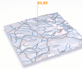 Places with similar names to Dilau, Nigeria ::
Disclaimer :: Information on this page comes without warranty of any kind |
||
|
Where is Dilau? Elevation and coordinates ::
Latitude (lat): 8°52'0"N Longitude (lon): 11°34'0"E
Elevation (approx.): 504m (map arrows pan, magnifying glasses zoom) |
||
|
Visiting Dilau? Hotel/Accommodation ::
Book a hotel in Dilau Travel Guide ::
Buy a travel guide for Nigeria rental cars ::
car rental offers GPS waypoint ::
download a GPX waypoint (PoI) of Dilau for your GPS receiver
|
||