|
search place name
|
||
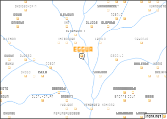
Eggua (Gongola, Nigeria)Eggua is a town in the Gongola region of Nigeria. An overview map of the region around Eggua is displayed below.
regional and 3d topo map of Eggua, Nigeria ::
Eggua airports ::
The nearest airport is LOS - Lagos Murtala Muhammed, located 70.0 km south east of Eggua.
Other airports nearby include COO - Cotonou Cadjehoun (95.5 km south west), IBA - Ibadan (124.0 km east), LFW - Lome Gnassingbe Eyadema Intl (206.6 km south west), ILR - Ilorin (233.6 km north east), Nearby towns ::
Idi Ori (1.9km north) //
Igan Alade (1.9km north) //
Imoto Igboiyewa (4.1km north west) //
Imoto Odan (5.2km north west) //
Lasilo (5.2km north east) //
Shagbon (5.2km south east) //
Tata Market (5.9km north) //
Igbo Ita (6.6km north west) //
Igbogila (7.4km east) //
Agbon (7.6km west) //
Oluode (7.6km north) //
Ika (8.3km north west) //
Gberedu (9.2km south west) //
Olofinji (9.2km north east) //
[all distances 'as the bird flies' and approximate] 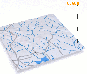 Places with similar names to Eggua, Nigeria ::
Disclaimer :: Information on this page comes without warranty of any kind |
||
|
Where is Eggua? Elevation and coordinates ::
Latitude (lat): 7°3'0"N Longitude (lon): 2°54'0"E
Elevation (approx.): 25m (map arrows pan, magnifying glasses zoom) |
||
|
Visiting Eggua? Hotel/Accommodation ::
Book a hotel in Eggua Travel Guide ::
Buy a travel guide for Nigeria rental cars ::
car rental offers GPS waypoint ::
download a GPX waypoint (PoI) of Eggua for your GPS receiver
|
||