|
search place name
|
||
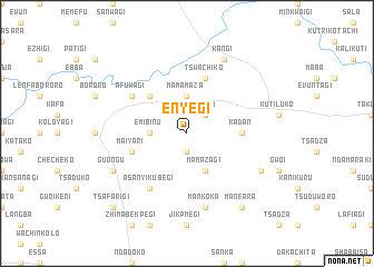
Enyegi (Gongola, Nigeria)Enyegi is a town in the Gongola region of Nigeria. An overview map of the region around Enyegi is displayed below.
regional and 3d topo map of Enyegi, Nigeria ::
Enyegi airports ::
The nearest airport is MXJ - Minna New, located 54.7 km north of Enyegi.
Other airports nearby include ABV - Abuja Nnamdi Azikiwe Intl (100.1 km east), KAD - Kaduna (198.9 km north east), ILR - Ilorin (221.1 km west), AKR - Akure (242.6 km south west), Nearby towns ::
Momodiko Liman (1.9km south) //
Kodogi (2.6km north east) //
Mama Maza (3.7km north) //
Emibinu (3.7km west) //
Mama Zagi (4.1km south east) //
Kenchikaza (5.2km north west) //
Kadan (5.5km east) //
Tswachiko (5.9km north) //
Maiyari (5.8km west) //
Afuwagi (6.6km north west) //
Asanyi Kubegi (6.7km south west) //
Mankoka (7.6km south) //
Kangi (8.3km north east) //
Gbankoroko (8.2km south east) //
Guongu (8.2km south west) //
Maneara (9.2km south east) //
Tsafarigi (10.4km south west) //
[all distances 'as the bird flies' and approximate] 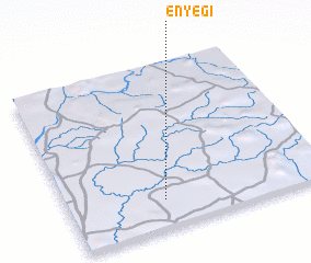 Places with similar names to Enyegi, Nigeria :: Disclaimer :: Information on this page comes without warranty of any kind |
||
|
Where is Enyegi? Elevation and coordinates ::
Latitude (lat): 9°10'0"N Longitude (lon): 6°22'0"E
Elevation (approx.): 106m (map arrows pan, magnifying glasses zoom) |
||
|
Visiting Enyegi? Hotel/Accommodation ::
Book a hotel in Enyegi Travel Guide ::
Buy a travel guide for Nigeria rental cars ::
car rental offers GPS waypoint ::
download a GPX waypoint (PoI) of Enyegi for your GPS receiver
|
||