|
search place name
|
||
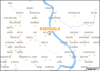
Ewendiulu (Gongola, Nigeria)Ewendiulu is a town in the Gongola region of Nigeria. An overview map of the region around Ewendiulu is displayed below.
regional and 3d topo map of Ewendiulu, Nigeria ::
Ewendiulu airports ::
The nearest airport is CBQ - Calabar, located 62.5 km south east of Ewendiulu.
Other airports nearby include ENU - Enugu (125.6 km north west), PHC - Port Hartcourt Port Harcourt Intl (127.0 km west), SSG - Malabo (200.8 km south), TKC - Tiko (210.5 km south east), Nearby towns ::
Ewe (1.8km west) //
Akpasip (2.6km north east) //
Amachi (4.1km south west) //
Aba Isu (5.2km south west) //
Ewe (5.5km west) //
Amukabi (5.8km west) //
Ogodumofan (5.9km north) //
Esukpai (6.7km south east) //
Mbiabong (6.7km north west) //
Ali Ukwa (6.7km north west) //
Ikot Okporo (7.6km east) //
Ndekpo (7.6km east) //
Obieze (7.6km west) //
Ikot Ana (7.6km north) //
Ufut (7.6km north) //
Agade (7.8km north west) //
Itan (8.3km south east) //
Ukwa Nkasi (9.3km north west) //
Amaruran (10.5km south east) //
[all distances 'as the bird flies' and approximate] 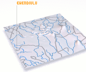 Places with similar names to Ewendiulu, Nigeria :: Disclaimer :: Information on this page comes without warranty of any kind |
||
|
Where is Ewendiulu? Elevation and coordinates ::
Latitude (lat): 5°26'0"N Longitude (lon): 8°1'0"E
Elevation (approx.): 12m (map arrows pan, magnifying glasses zoom) |
||
|
Visiting Ewendiulu? Hotel/Accommodation ::
Book a hotel in Ewendiulu Travel Guide ::
Buy a travel guide for Nigeria rental cars ::
car rental offers GPS waypoint ::
download a GPX waypoint (PoI) of Ewendiulu for your GPS receiver
|
||