|
search place name
|
||
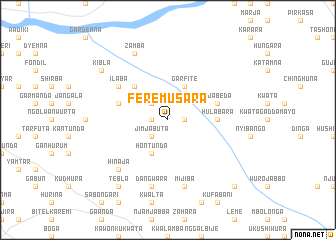
Fere Musara (Gongola, Nigeria)Fere Musara is a town in the Gongola region of Nigeria. An overview map of the region around Fere Musara is displayed below.
regional and 3d topo map of Fere Musara, Nigeria ::
Fere Musara airports ::
The nearest airport is YOL - Yola, located 110.0 km south of Fere Musara.
Other airports nearby include GOU - Garoua (139.0 km south east), MIU - Maiduguri (188.6 km north), MVR - Maroua Salak (193.8 km east), Nearby towns ::
Amtasa (1.8km west) //
Hurunda (1.8km east) //
Kitirinda (1.8km west) //
Barni (2.6km north west) //
Guyaku (2.6km north west) //
Jimjabuta (2.6km south west) //
Hontunda (4.1km south west) //
Garfite (4.1km north east) //
Bebe (5.2km north west) //
Hulabara (5.5km east) //
Mulabara (5.8km east) //
Ujabeda (5.8km east) //
Balhona (5.8km west) //
Ilaba (6.6km north west) //
Dangwara (7.6km south) //
Mijiba (7.6km south) //
Hinaja (7.8km south west) //
Zamba (8.3km north west) //
Tebla (9.2km south west) //
Kibla (9.2km north west) //
Shimkwari (10.4km south east) //
[all distances 'as the bird flies' and approximate]  Places with similar names to Fere Musara, Nigeria :: Disclaimer :: Information on this page comes without warranty of any kind |
||
|
Where is Fere Musara? Elevation and coordinates ::
Latitude (lat): 10°15'0"N Longitude (lon): 12°30'0"E
Elevation (approx.): 378m (map arrows pan, magnifying glasses zoom) |
||
|
Visiting Fere Musara? Hotel/Accommodation ::
Book a hotel in Fere Musara Travel Guide ::
Buy a travel guide for Nigeria rental cars ::
car rental offers GPS waypoint ::
download a GPX waypoint (PoI) of Fere Musara for your GPS receiver
|
||