|
search place name
|
||
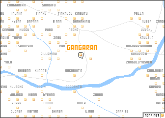
Gangaran (Gongola, Nigeria)Gangaran is a town in the Gongola region of Nigeria. An overview map of the region around Gangaran is displayed below.
regional and 3d topo map of Gangaran, Nigeria ::
Gangaran airports ::
The nearest airport is YOL - Yola, located 126.4 km south of Gangaran.
Other airports nearby include GOU - Garoua (156.2 km south east), MIU - Maiduguri (175.8 km north east), MVR - Maroua Salak (199.8 km east), Nearby towns ::
Chimabulu (1.8km east) //
Sakasimta (4.1km south west) //
Rabasu (4.1km north west) //
Garin Gwagsa (4.1km north west) //
Kwaramba (5.2km north west) //
Bwal Pakla (5.5km west) //
Kwalanba (5.9km north) //
Kwajaffa Babur (5.9km north) //
Nboha (5.9km north) //
Garsungu (5.8km west) //
Mindi Pella (6.6km north west) //
Zabu (6.6km north west) //
Puba (6.6km north west) //
Pillamindi (7.3km west) //
Shahahiru (7.4km north) //
Kadama (7.6km north) //
Gardemna (7.6km south) //
Bangdi (8.2km north west) //
Puba (9.2km north west) //
Imana (9.2km north west) //
[all distances 'as the bird flies' and approximate] 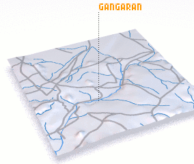 Places with similar names to Gangaran, Nigeria ::
// Caangrian (PH)
// Canigaran (PH)
// Kānī Gurān (IQ)
// Göynükören (TR)
// Göynükören (TR)
// Göynükören (TR)
// Göynükören (TR)
// Göynükören (TR)
// Göynükören (TR)
// Güneygören (TR)
Disclaimer :: Information on this page comes without warranty of any kind |
||
|
Where is Gangaran? Elevation and coordinates ::
Latitude (lat): 10°24'0"N Longitude (lon): 12°26'0"E
Elevation (approx.): 369m (map arrows pan, magnifying glasses zoom) |
||
|
Visiting Gangaran? Hotel/Accommodation ::
Book a hotel in Gangaran Travel Guide ::
Buy a travel guide for Nigeria rental cars ::
car rental offers GPS waypoint ::
download a GPX waypoint (PoI) of Gangaran for your GPS receiver
|
||