|
search place name
|
||
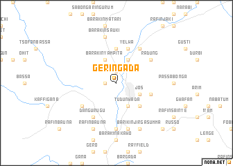
Gerin Gada (Gongola, Nigeria)Gerin Gada is a town in the Gongola region of Nigeria. An overview map of the region around Gerin Gada is displayed below.
regional and 3d topo map of Gerin Gada, Nigeria ::
Gerin Gada airports ::
The nearest airport is JOS - Jos Yakubu Gowon, located 32.5 km south of Gerin Gada.
Other airports nearby include ZAR - Zaria (185.0 km north west), KAD - Kaduna (189.2 km north west), ABV - Abuja Nnamdi Azikiwe Intl (203.7 km south west), Nearby towns ::
Rafin Par (1.9km north) //
Layi Russo (1.9km north) //
Barakin Rafin Gora (1.8km west) //
Barakin Sabon (1.9km north) //
Tudun Wada (4.1km south east) //
Jos (4.1km south east) //
Barakin Naraguta (4.1km north east) //
Barakin Yampita (4.1km north west) //
Dogon Karfi (5.2km south east) //
Gamajigo (5.6km north) //
Gwong (5.8km east) //
Yelwa (5.9km north) //
Barakin Dangurugu (6.6km south west) //
Naraguta Hausawa (6.7km north east) //
Dangurugu (6.7km south west) //
Radung (6.6km north east) //
Anglo Jos (7.4km south) //
Barakin Lerawi (7.6km south) //
Barakin Sauki (7.6km north) //
Barikin Jirga Summa (8.3km south east) //
Rafin Bauna (8.3km south west) //
Barakin Delimi Sabuwa (10.4km south east) //
[all distances 'as the bird flies' and approximate] 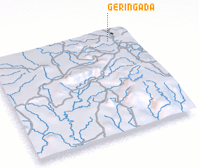 Places with similar names to Gerin Gada, Nigeria :: Disclaimer :: Information on this page comes without warranty of any kind |
||
|
Where is Gerin Gada? Elevation and coordinates ::
Latitude (lat): 9°56'0"N Longitude (lon): 8°52'0"E
Elevation (approx.): 1177m (map arrows pan, magnifying glasses zoom) |
||
|
Visiting Gerin Gada? Hotel/Accommodation ::
Book a hotel in Gerin Gada Travel Guide ::
Buy a travel guide for Nigeria rental cars ::
car rental offers GPS waypoint ::
download a GPX waypoint (PoI) of Gerin Gada for your GPS receiver
|
||