|
search place name
|
||
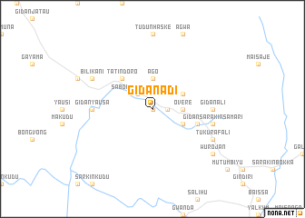
Gidan Adi (Gongola, Nigeria)Gidan Adi is a town in the Gongola region of Nigeria. An overview map of the region around Gidan Adi is displayed below.
regional and 3d topo map of Gidan Adi, Nigeria ::
Gidan Adi airports ::
The nearest airport is BPC - Bamenda, located 149.6 km south of Gidan Adi.
Other airports nearby include FOM - Foumban Nkounja (189.4 km south), BFX - Bafoussam (199.5 km south), MDI - Makurdi (214.0 km west), YOL - Yola (299.6 km north east), Nearby towns ::
Dameya (0.0km north) //
Kamindua (1.8km east) //
Sabon Gida Tukura (2.6km north west) //
Overe (3.7km east) //
Didan (3.7km east) //
Ago (3.7km north) //
Asibi (4.1km south east) //
Achifeten (4.1km north east) //
Tatindoro (5.2km north west) //
Gajeri (5.8km east) //
Danbecki (5.8km east) //
Gidan Ali (7.4km east) //
Gidan Yausa (7.4km west) //
Gidan Sarakin Samari (7.6km east) //
Gidan Hassan (8.2km south east) //
Tukura Fali (8.2km south east) //
Bilikani (8.2km north west) //
Wurojan (9.2km south east) //
[all distances 'as the bird flies' and approximate] 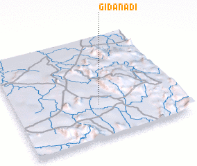 Places with similar names to Gidan Adi, Nigeria ::
// Gîdinţi (RO)
// Jednota (US)
// Jote Notai (BD)
// Gitandi (RW)
// Gidan Ada (NG)
// Gidan Ada (NG)
// Gidan Ati (NG)
// Gidan Atta (NG)
// Gidan Atu (NG)
// Gidan Idi (NG)
Disclaimer :: Information on this page comes without warranty of any kind |
||
|
Where is Gidan Adi? Elevation and coordinates ::
Latitude (lat): 7°20'0"N Longitude (lon): 10°31'0"E
Elevation (approx.): 225m (map arrows pan, magnifying glasses zoom) |
||
|
Visiting Gidan Adi? Hotel/Accommodation ::
Book a hotel in Gidan Adi Travel Guide ::
Buy a travel guide for Nigeria rental cars ::
car rental offers GPS waypoint ::
download a GPX waypoint (PoI) of Gidan Adi for your GPS receiver
|
||