|
search place name
|
||
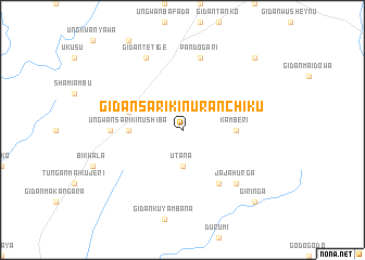
Gidan Sarikin Uran Chiku (Gongola, Nigeria)Gidan Sarikin Uran Chiku is a town in the Gongola region of Nigeria. An overview map of the region around Gidan Sarikin Uran Chiku is displayed below.
regional and 3d topo map of Gidan Sarikin Uran Chiku, Nigeria ::
Gidan Sarikin Uran Chiku airports ::
The nearest airport is MXJ - Minna New, located 75.7 km south of Gidan Sarikin Uran Chiku.
Other airports nearby include KAD - Kaduna (108.4 km east), ZAR - Zaria (166.0 km north east), ABV - Abuja Nnamdi Azikiwe Intl (174.6 km south east), QUS - Gusau (205.9 km north), Nearby towns ::
Utana (3.7km south) //
Kamberi (5.5km east) //
Ungwan Sarikin Ushiba (5.5km west) //
Gidan Ushiba (5.8km west) //
Gidan Shabagu (5.8km west) //
Gidan Usman Danladi (6.6km south east) //
Gidan Sarikin Noma (6.6km south east) //
Gidan Damao (7.3km west) //
Pandogari (7.6km north) //
Jaja Hurga (7.8km south east) //
Gidan Tetige (8.3km north west) //
Giringa (10.4km south east) //
Gidan Madawakin Tugulbi (10.4km north east) //
[all distances 'as the bird flies' and approximate] 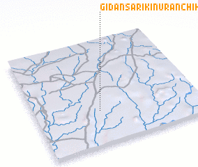 Places with similar names to Gidan Sarikin Uran Chiku, Nigeria :: Disclaimer :: Information on this page comes without warranty of any kind |
||
|
Where is Gidan Sarikin Uran Chiku? Elevation and coordinates ::
Latitude (lat): 10°20'0"N Longitude (lon): 6°24'0"E
Elevation (approx.): 405m (map arrows pan, magnifying glasses zoom) |
||
|
Visiting Gidan Sarikin Uran Chiku? Hotel/Accommodation ::
Book a hotel in Gidan Sarikin Uran Chiku Travel Guide ::
Buy a travel guide for Nigeria rental cars ::
car rental offers GPS waypoint ::
download a GPX waypoint (PoI) of Gidan Sarikin Uran Chiku for your GPS receiver
|
||