|
search place name
|
||
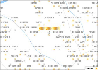
Huruhwana (Gongola, Nigeria)Huruhwana is a town in the Gongola region of Nigeria. An overview map of the region around Huruhwana is displayed below.
regional and 3d topo map of Huruhwana, Nigeria ::
Huruhwana airports ::
The nearest airport is YOL - Yola, located 110.2 km south of Huruhwana.
Other airports nearby include GOU - Garoua (128.0 km south east), MVR - Maroua Salak (179.5 km east), MIU - Maiduguri (186.0 km north), Nearby towns ::
Dinga (0.0km north) //
Hushibura (3.6km east) //
Kwata Gaddamayo (4.1km north west) //
Bebe (4.1km north west) //
Kwata (5.2km north west) //
Chinghuna (5.6km north) //
Nyibango (5.5km west) //
Usenyi Ngurore (5.8km east) //
Chabatta (5.8km east) //
Dahai (5.9km south) //
Wuro Jabbo (6.6km south west) //
Lubu (6.6km north east) //
Njuda (6.6km south east) //
Dongo Jaure Usman (7.5km east) //
Upuba (8.2km south east) //
Katamna (8.3km north west) //
Gujela (8.3km north east) //
Shimkwari (9.2km south west) //
Kpawa (9.2km south east) //
[all distances 'as the bird flies' and approximate] 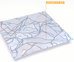 Places with similar names to Huruhwana, Nigeria ::
Disclaimer :: Information on this page comes without warranty of any kind |
||
|
Where is Huruhwana? Elevation and coordinates ::
Latitude (lat): 10°14'0"N Longitude (lon): 12°38'0"E
Elevation (approx.): 466m (map arrows pan, magnifying glasses zoom) |
||
|
Visiting Huruhwana? Hotel/Accommodation ::
Book a hotel in Huruhwana Travel Guide ::
Buy a travel guide for Nigeria rental cars ::
car rental offers GPS waypoint ::
download a GPX waypoint (PoI) of Huruhwana for your GPS receiver
|
||