|
search place name
|
||
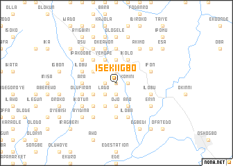
Iseki Igbo (Gongola, Nigeria)Iseki Igbo is a town in the Gongola region of Nigeria. An overview map of the region around Iseki Igbo is displayed below.
regional and 3d topo map of Iseki Igbo, Nigeria ::
Iseki Igbo airports ::
The nearest airport is ILR - Ilorin, located 65.6 km north of Iseki Igbo.
Other airports nearby include IBA - Ibadan (73.7 km south west), AKR - Akure (116.7 km south east), LOS - Lagos Murtala Muhammed (186.8 km south west), BNI - Benin (212.9 km south east), Nearby towns ::
Aganna (0.0km north) //
Isangbe Oye (1.8km west) //
Komini (1.8km east) //
Imofo (1.9km south) //
Aba Bale (1.9km north) //
Iseki (1.8km east) //
Ilawe (1.9km north) //
Ijagemo (2.6km south west) //
Lado (2.6km south west) //
Ojo (3.7km south) //
Magele (3.7km north) //
Iwonso (3.7km north) //
Aba Bale (4.1km south west) //
Yemope (4.1km north west) //
Adodo (4.1km south west) //
Alarasan (4.1km south west) //
Akeyan (4.1km north west) //
Aro (4.1km south east) //
Ikolo (4.1km north east) //
Alate (5.2km south west) //
Akinlade (5.2km south west) //
Abudo (5.2km south west) //
Wainwain (5.2km north west) //
Ajo (5.2km north west) //
Ara (5.5km west) //
Abule Iya Agba (5.6km south) //
Ilajue (5.6km north) //
Okeawon (5.9km north) //
Bale Ile Oba (5.9km north) //
[all distances 'as the bird flies' and approximate] 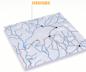 Places with similar names to Iseki Igbo, Nigeria ::
// Izakagbo (NG)
Disclaimer :: Information on this page comes without warranty of any kind |
||
|
Where is Iseki Igbo? Elevation and coordinates ::
Latitude (lat): 7°51'0"N Longitude (lon): 4°26'0"E
Elevation (approx.): 334m (map arrows pan, magnifying glasses zoom) |
||
|
Visiting Iseki Igbo? Hotel/Accommodation ::
Book a hotel in Iseki Igbo Travel Guide ::
Buy a travel guide for Nigeria rental cars ::
car rental offers GPS waypoint ::
download a GPX waypoint (PoI) of Iseki Igbo for your GPS receiver
|
||