|
search place name
|
||
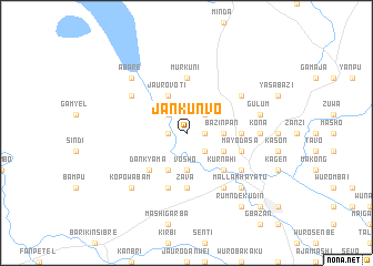
Jankunvo (Gongola, Nigeria)Jankunvo is a town in the Gongola region of Nigeria. An overview map of the region around Jankunvo is displayed below.
regional and 3d topo map of Jankunvo, Nigeria ::
Jankunvo airports ::
The nearest airport is YOL - Yola, located 130.6 km east of Jankunvo.
Nearby towns ::
Wuro Tafida (1.8km west) //
Jauro Nubin (1.8km west) //
Kajang (1.8km east) //
Jauro Noko (2.6km north west) //
Murubai (2.6km north west) //
Baza (2.6km north east) //
Janbargu (2.6km south east) //
Jauro Shofo (3.7km south) //
Vosho (3.7km south) //
Bazinpan (3.7km east) //
Mashi Lawan (4.1km south west) //
Jauro Voti (4.1km north west) //
Jenbambu (4.1km south east) //
Dankyama (5.2km south west) //
Kurnahi (5.2km south east) //
Jauro Miya (5.2km south east) //
Zava (5.6km south) //
Gbaza (5.5km east) //
Jauro Yinu (5.6km south) //
Murkuni (5.6km north) //
Nyakpan (5.9km south) //
Mayo Dasa (5.8km east) //
Kentiel (6.6km south east) //
Kona Garu (6.6km north east) //
Abbare (6.6km north west) //
Jauro Bamvo (6.7km south east) //
Kona (7.3km east) //
Gulum (7.6km east) //
Mallam Hayatu (7.8km south east) //
[all distances 'as the bird flies' and approximate]  Places with similar names to Jankunvo, Nigeria ::
// Giòng Ông Hổ (VN)
// Jinqianghe (CN)
Disclaimer :: Information on this page comes without warranty of any kind |
||
|
Where is Jankunvo? Elevation and coordinates ::
Latitude (lat): 8°57'0"N Longitude (lon): 11°17'0"E
Elevation (approx.): 180m (map arrows pan, magnifying glasses zoom) |
||
|
Visiting Jankunvo? Hotel/Accommodation ::
Book a hotel in Jankunvo Travel Guide ::
Buy a travel guide for Nigeria rental cars ::
car rental offers GPS waypoint ::
download a GPX waypoint (PoI) of Jankunvo for your GPS receiver
|
||