|
search place name
|
||
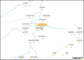
Jonam (Gongola, Nigeria)Jonam is a town in the Gongola region of Nigeria. An overview map of the region around Jonam is displayed below.
regional and 3d topo map of Jonam, Nigeria ::
Jonam airports ::
The nearest airport is MDI - Makurdi, located 160.9 km west of Jonam.
Other airports nearby include BPC - Bamenda (198.5 km south), JOS - Jos Yakubu Gowon (239.3 km north west), Nearby towns ::
Kpara (1.8km west) //
Ioiya (1.8km west) //
Shoho (2.6km north west) //
Bayawal (3.7km south) //
Yiwamba (3.7km north) //
Tor Ruwam (5.9km north) //
Agame (5.8km west) //
Mai Dakin Sama (6.7km south west) //
Ngbebe (7.3km west) //
Wotire (7.6km west) //
Jatou (7.6km west) //
Ajetola (7.6km west) //
Guruza (7.8km south west) //
Tsokundi (7.8km north west) //
Ashiya (9.2km south west) //
[all distances 'as the bird flies' and approximate]  Places with similar names to Jonam, Nigeria ::
Disclaimer :: Information on this page comes without warranty of any kind |
||
|
Where is Jonam? Elevation and coordinates ::
Latitude (lat): 7°50'0"N Longitude (lon): 10°4'0"E
Elevation (approx.): 127m (map arrows pan, magnifying glasses zoom) |
||
|
Visiting Jonam? Hotel/Accommodation ::
Book a hotel in Jonam Travel Guide ::
Buy a travel guide for Nigeria rental cars ::
car rental offers GPS waypoint ::
download a GPX waypoint (PoI) of Jonam for your GPS receiver
|
||