|
search place name
|
||
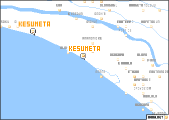
Kesumeta (Gongola, Nigeria)Kesumeta is a town in the Gongola region of Nigeria. An overview map of the region around Kesumeta is displayed below.
regional and 3d topo map of Kesumeta, Nigeria ::
Kesumeta airports ::
The nearest airport is BNI - Benin, located 118.0 km east of Kesumeta.
Other airports nearby include IBA - Ibadan (132.5 km north west), AKR - Akure (134.8 km north east), LOS - Lagos Murtala Muhammed (137.6 km west), Nearby towns ::
Araromi Odo (2.6km north east) //
Olokata (4.0km north west) //
Araromi Oke (4.1km north east) //
Epene (5.2km south east) //
Ogogoro (7.4km east) //
Irokun (7.6km north) //
Agbala (10.5km north east) //
[all distances 'as the bird flies' and approximate] 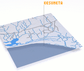 Places with similar names to Kesumeta, Nigeria ::
// Casamata (PH)
// Kismet (US)
// Kismet (US)
// Case Matte (IT)
// Csomád (HU)
// Kosmata (BG)
// Cuşmed (RO)
// Casa Matao (ES)
// Kismet (US)
// Kismat (BD)
Disclaimer :: Information on this page comes without warranty of any kind |
||
|
Where is Kesumeta? Elevation and coordinates ::
Latitude (lat): 6°18'0"N Longitude (lon): 4°32'0"E
Elevation (approx.): 4m (map arrows pan, magnifying glasses zoom) |
||
|
Visiting Kesumeta? Hotel/Accommodation ::
Book a hotel in Kesumeta Travel Guide ::
Buy a travel guide for Nigeria rental cars ::
car rental offers GPS waypoint ::
download a GPX waypoint (PoI) of Kesumeta for your GPS receiver
|
||