|
search place name
|
||
Koko (Gongola, Nigeria)Koko is a town in the Gongola region of Nigeria. An overview map of the region around Koko is displayed below.
regional and 3d topo map of Koko, Nigeria ::

Koko airports ::
The nearest airport is YOL - Yola, located 91.3 km north east of Koko.
Other airports nearby include GOU - Garoua (192.5 km east), NGE - N'gaoundere Ngaoundere (271.8 km south east), Nearby towns ::
Tagima (2.6km north west) //
Nmadi (3.7km south) //
Duka (3.7km east) //
Kozan (3.7km west) //
Yakoko (4.1km south east) //
Jasori (4.1km north west) //
Zang (5.2km south east) //
Jauro Mani Nzebe (5.2km south west) //
Bori Zinha (5.8km east) //
Manza (5.9km south) //
Busoboro (6.7km south east) //
Mika (6.7km north west) //
Lanapo (7.6km south) //
Jasori (7.6km east) //
Metantan (7.6km east) //
Tabon (7.6km west) //
Leya (7.6km west) //
Koron (8.2km north west) //
Bansi (9.2km south east) //
Nyavo (9.2km south east) //
Bidako (9.2km north east) //
Zandi (9.2km north east) //
Koko (10.4km north east) //
Lonkwo Bakari (10.4km south west) //
[all distances 'as the bird flies' and approximate] 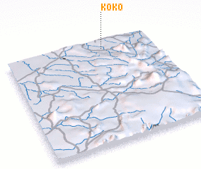 Places with similar names to Koko, Nigeria ::
Disclaimer :: Information on this page comes without warranty of any kind |
||
|
Where is Koko? Elevation and coordinates ::
Latitude (lat): 8°56'0"N Longitude (lon): 11°40'0"E
Elevation (approx.): 481m (map arrows pan, magnifying glasses zoom) |
||
|
Visiting Koko? Hotel/Accommodation ::
Book a hotel in Koko Travel Guide ::
Buy a travel guide for Nigeria rental cars ::
car rental offers GPS waypoint ::
download a GPX waypoint (PoI) of Koko for your GPS receiver
|
||