|
search place name
|
||
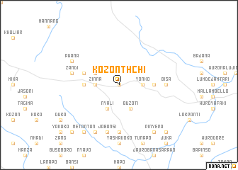
Kozonthchi (Gongola, Nigeria)Kozonthchi is a town in the Gongola region of Nigeria. An overview map of the region around Kozonthchi is displayed below.
regional and 3d topo map of Kozonthchi, Nigeria ::
Kozonthchi airports ::
The nearest airport is YOL - Yola, located 77.3 km north east of Kozonthchi.
Other airports nearby include GOU - Garoua (178.7 km east), NGE - N'gaoundere Ngaoundere (265.8 km south east), Nearby towns ::
Bubon (0.0km north) //
Zinna (3.7km west) //
Dendi (3.7km east) //
Yonko (3.7km east) //
Nyali (4.1km south west) //
Buzoti (4.1km south east) //
Dossa (4.1km north west) //
Nasari (5.5km east) //
Bidako (5.5km west) //
Koko (5.8km west) //
Gboule (7.4km south) //
Bisa (7.3km east) //
Jabansi (7.6km south) //
Zandi (7.6km west) //
Bushanki (8.3km south west) //
Pwana (8.2km north west) //
Pinyera (9.2km south east) //
Jasori (9.2km south west) //
Metantan (9.2km south west) //
Bori Zinha (10.4km south west) //
Kokosi (10.4km south east) //
[all distances 'as the bird flies' and approximate] 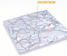 Places with similar names to Kozonthchi, Nigeria :: Disclaimer :: Information on this page comes without warranty of any kind |
||
|
Where is Kozonthchi? Elevation and coordinates ::
Latitude (lat): 8°59'0"N Longitude (lon): 11°47'0"E
Elevation (approx.): 542m (map arrows pan, magnifying glasses zoom) |
||
|
Visiting Kozonthchi? Hotel/Accommodation ::
Book a hotel in Kozonthchi Travel Guide ::
Buy a travel guide for Nigeria rental cars ::
car rental offers GPS waypoint ::
download a GPX waypoint (PoI) of Kozonthchi for your GPS receiver
|
||