|
search place name
|
||
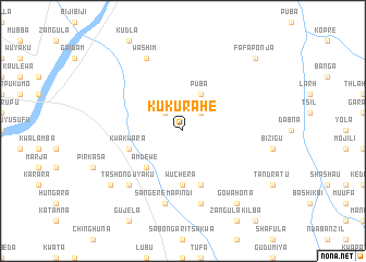
Kukurahe (Gongola, Nigeria)Kukurahe is a town in the Gongola region of Nigeria. An overview map of the region around Kukurahe is displayed below.
regional and 3d topo map of Kukurahe, Nigeria ::
Kukurahe airports ::
The nearest airport is YOL - Yola, located 128.4 km south of Kukurahe.
Other airports nearby include GOU - Garoua (136.2 km south east), MIU - Maiduguri (167.6 km north), MVR - Maroua Salak (168.9 km east), Nearby towns ::
Mubang (2.6km north east) //
Dilimbula (2.6km north east) //
Kinging (2.6km north east) //
Gab (2.6km north west) //
Puba (4.1km north east) //
Amdewe (5.2km south west) //
Wuchera (5.6km south) //
Mizhalma (5.6km south) //
Kwakwara (5.8km west) //
Gudawi (5.9km south) //
Katuala (7.6km south) //
Makule (7.6km south) //
Sangere Mapindi (7.6km south) //
Balhana (7.6km south) //
Guyaku (7.8km south west) //
Tashon Guyaku (7.8km south west) //
Washim (8.3km north west) //
Gowahona (9.2km south east) //
Kujela (9.2km south west) //
Fafaponja (10.4km north east) //
[all distances 'as the bird flies' and approximate] 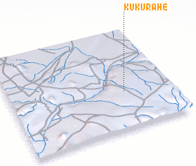 Places with similar names to Kukurahe, Nigeria ::
Disclaimer :: Information on this page comes without warranty of any kind |
||
|
Where is Kukurahe? Elevation and coordinates ::
Latitude (lat): 10°23'0"N Longitude (lon): 12°43'0"E
Elevation (approx.): 447m (map arrows pan, magnifying glasses zoom) |
||
|
Visiting Kukurahe? Hotel/Accommodation ::
Book a hotel in Kukurahe Travel Guide ::
Buy a travel guide for Nigeria rental cars ::
car rental offers GPS waypoint ::
download a GPX waypoint (PoI) of Kukurahe for your GPS receiver
|
||