|
search place name
|
||
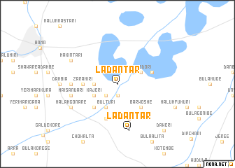
Ladantar (Gongola, Nigeria)Ladantar is a town in the Gongola region of Nigeria. An overview map of the region around Ladantar is displayed below.
regional and 3d topo map of Ladantar, Nigeria ::
Ladantar airports ::
The nearest airport is MIU - Maiduguri, located 89.4 km north west of Ladantar.
Other airports nearby include MVR - Maroua Salak (122.9 km south east), NDJ - N'djamena Ndjamena Hassan Djamous (153.4 km north east), Nearby towns ::
Kidari (1.9km south) //
Bula Munjari (2.6km north west) //
Bulongu (2.6km south west) //
Burari (3.6km west) //
Ngurosoye (3.6km west) //
Ngubdori (4.1km north east) //
Kajeri (4.1km south west) //
Bulturi (4.1km south west) //
Barwoshe (5.2km south east) //
Jangurori (5.2km south west) //
Mai Mairamri (5.2km south west) //
Zaramiri (5.4km west) //
Bula Morube (5.8km east) //
Nasawa (5.8km south) //
Juwa (5.8km south) //
Shiam (7.3km west) //
Ladantar (7.6km south) //
Maisandari (7.5km west) //
Arawane (7.5km west) //
Makintari (8.2km north west) //
Malam Gonare (8.2km south west) //
Daweri (10.4km south east) //
[all distances 'as the bird flies' and approximate] 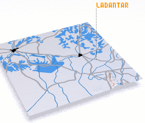 Places with similar names to Ladantar, Nigeria ::
// Ladantar (NG)
// La Tendrie (HT)
Disclaimer :: Information on this page comes without warranty of any kind |
||
|
Where is Ladantar? Elevation and coordinates ::
Latitude (lat): 11°28'0"N Longitude (lon): 13°48'0"E
Elevation (approx.): 324m (map arrows pan, magnifying glasses zoom) |
||
|
Visiting Ladantar? Hotel/Accommodation ::
Book a hotel in Ladantar Travel Guide ::
Buy a travel guide for Nigeria rental cars ::
car rental offers GPS waypoint ::
download a GPX waypoint (PoI) of Ladantar for your GPS receiver
|
||