|
search place name
|
||
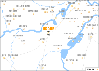
Madobi (Kano, Nigeria)Madobi is a town in the Kano region of Nigeria. An overview map of the region around Madobi is displayed below.
regional and 3d topo map of Madobi, Nigeria ::
Madobi airports ::
The nearest airport is KAN - Kano Mallam Aminu Intl, located 39.5 km north east of Madobi.
Other airports nearby include ZAR - Zaria (97.2 km south west), KAD - Kaduna (159.6 km south west), QUS - Gusau (178.8 km west), MFG - Maradi (228.8 km north west), Nearby towns ::
Rafin Dodo (0.9km north west) //
Shafe (3.4km south west) //
Ginkoso (3.7km north west) //
Dumi (4.4km south west) //
Rikadawa (5.8km south east) //
Gora (6.3km north east) //
Damurna (6.6km north) //
Dan Zogari (6.9km north) //
Kubarachi (7.4km east) //
Ruga (8.0km north) //
Kazode (9.1km north) //
Bakin Kogi (8.9km east) //
Ungwan Sora Gora (9.2km north east) //
Alwali (9.4km north east) //
Massanawa (10.1km north west) //
[all distances 'as the bird flies' and approximate]  Places with similar names to Madobi, Nigeria ::
Disclaimer :: Information on this page comes without warranty of any kind |
||
|
Where is Madobi? Elevation and coordinates ::
Latitude (lat): 11°46'38"N Longitude (lon): 8°17'18"E
Elevation (approx.): 492m (map arrows pan, magnifying glasses zoom) |
||
|
Visiting Madobi? Hotel/Accommodation ::
Book a hotel in Madobi Travel Guide ::
Buy a travel guide for Nigeria rental cars ::
car rental offers GPS waypoint ::
download a GPX waypoint (PoI) of Madobi for your GPS receiver
|
||