|
search place name
|
||
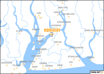
Monikiri (Gongola, Nigeria)Monikiri is a town in the Gongola region of Nigeria. An overview map of the region around Monikiri is displayed below.
regional and 3d topo map of Monikiri, Nigeria ::
Monikiri airports ::
The nearest airport is PHC - Port Hartcourt Port Harcourt Intl, located 98.3 km north east of Monikiri.
Other airports nearby include BNI - Benin (225.5 km north), Nearby towns ::
Ebekiri (1.4km north east) //
Samsonkiri (1.5km north west) //
Captninakiri (2.4km north) //
Kpongbokiri (2.6km west) //
Angaghakiri (3.2km north) //
Fantuo (3.5km south east) //
Ekemakiri (3.6km north east) //
Munighakiri (4.0km north east) //
Okpokiri (4.4km west) //
Walterkiri (4.6km west) //
Tomkiri (5.0km south west) //
Orukiri (6.1km west) //
Kinkiamabugo (6.2km north east) //
Kurugbaba (6.6km south west) //
Kala Orubou (7.0km west) //
Kanuskiri (7.5km south west) //
Ewelesua (8.1km north west) //
Oni (8.1km north west) //
Ijawkiri (8.4km north) //
Mbasikiri (8.9km north west) //
Ijaw (9.1km north west) //
Kalabilema (9.5km north east) //
Kirikakiri (9.6km south west) //
Golubokiri (10.0km north west) //
Erereghakiri (10.0km south east) //
Otokolopiri (11.2km south east) //
[all distances 'as the bird flies' and approximate]  Places with similar names to Monikiri, Nigeria ::
Disclaimer :: Information on this page comes without warranty of any kind |
||
|
Where is Monikiri? Elevation and coordinates ::
Latitude (lat): 4°24'18"N Longitude (lon): 6°18'22"E
Elevation (approx.): 5m (map arrows pan, magnifying glasses zoom) |
||
|
Visiting Monikiri? Hotel/Accommodation ::
Book a hotel in Monikiri Travel Guide ::
Buy a travel guide for Nigeria rental cars ::
car rental offers GPS waypoint ::
download a GPX waypoint (PoI) of Monikiri for your GPS receiver
|
||