|
search place name
|
||
Nasarawa (Kano, Nigeria)Nasarawa is a town in the Kano region of Nigeria. An overview map of the region around Nasarawa is displayed below.
regional and 3d topo map of Nasarawa, Nigeria ::
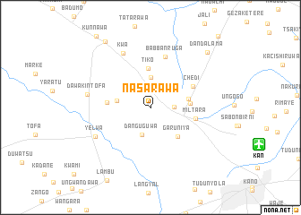
Nasarawa airports ::
The nearest airport is KAN - Kano Mallam Aminu Intl, located 14.1 km east of Nasarawa.
Other airports nearby include ZAR - Zaria (131.8 km south west), QUS - Gusau (185.9 km west), KAD - Kaduna (194.2 km south west), ZND - Zinder (197.3 km north), Nearby towns ::
Sabon Gari Bagadawa (2.8km north) //
Dawanau (2.9km east) //
Danguguwa (3.6km south) //
Bagadawa (3.7km north) //
Bambarawa (4.2km west) //
Tiko (4.9km north) //
Tumfafi (4.8km east) //
Bankaura (4.9km east) //
Garun Iya (4.9km south east) //
Tsarkakiya (5.4km west) //
Miltara (5.7km east) //
Chedi (5.8km north east) //
Babban Ruga (6.5km north) //
Kwa (7.5km north west) //
Yelwa (7.7km south west) //
Dawakin Tofa (7.9km west) //
Dan Dalama (9.7km north east) //
Dungurawa (9.9km north west) //
Kunnawa (11.1km north west) //
Kwidawa (12.1km north east) //
[all distances 'as the bird flies' and approximate] 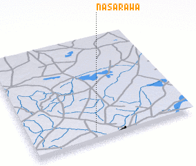 Places with similar names to Nasarawa, Nigeria ::
Disclaimer :: Information on this page comes without warranty of any kind |
||
|
Where is Nasarawa? Elevation and coordinates ::
Latitude (lat): 12°5'22"N Longitude (lon): 8°24'8"E
Elevation (approx.): 502m (map arrows pan, magnifying glasses zoom) |
||
|
Visiting Nasarawa? Hotel/Accommodation ::
Book a hotel in Nasarawa Travel Guide ::
Buy a travel guide for Nigeria rental cars ::
car rental offers GPS waypoint ::
download a GPX waypoint (PoI) of Nasarawa for your GPS receiver
|
||