|
search place name
|
||
Ndadoko (Gongola, Nigeria)Ndadoko is a town in the Gongola region of Nigeria. An overview map of the region around Ndadoko is displayed below.
regional and 3d topo map of Ndadoko, Nigeria ::

Ndadoko airports ::
The nearest airport is MXJ - Minna New, located 48.1 km north east of Ndadoko.
Other airports nearby include ABV - Abuja Nnamdi Azikiwe Intl (123.5 km east), KAD - Kaduna (197.0 km north east), ILR - Ilorin (209.6 km south west), ZAR - Zaria (259.5 km north east), Nearby towns ::
Tadagona (1.9km north) //
Emiginda (3.7km south) //
Natsu (3.7km south) //
Ndackchetama (4.1km north east) //
Swasun Amadu (4.1km north east) //
Bisanti (4.1km north east) //
Maraya (4.1km south east) //
Kakakpan (4.1km south east) //
Gbirafu (6.6km south east) //
Ewun (6.7km south east) //
Sagi (7.5km west) //
Kpakara (7.5km east) //
Ndabashi (7.5km east) //
Egbanasara (7.6km south) //
Nuwako (8.2km north west) //
Ndache (8.3km north east) //
Tswadan (10.4km south west) //
[all distances 'as the bird flies' and approximate] 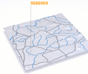 Places with similar names to Ndadoko, Nigeria ::
// Natthetke (MM)
// Natiédiougou (BF)
// Ndiatakh (SN)
// Ndia Tako (SN)
// Nditakh (SN)
// Néti Daga (SN)
// Ndadoko (NG)
// Ndiédougou (ML)
// Naudeh Taki (PK)
// Ndodougou (CI)
Disclaimer :: Information on this page comes without warranty of any kind |
||
|
Where is Ndadoko? Elevation and coordinates ::
Latitude (lat): 9°19'0"N Longitude (lon): 6°11'0"E
Elevation (approx.): 94m (map arrows pan, magnifying glasses zoom) |
||
|
Visiting Ndadoko? Hotel/Accommodation ::
Book a hotel in Ndadoko Travel Guide ::
Buy a travel guide for Nigeria rental cars ::
car rental offers GPS waypoint ::
download a GPX waypoint (PoI) of Ndadoko for your GPS receiver
|
||