|
search place name
|
||
New Libata (Gongola, Nigeria)New Libata is a town in the Gongola region of Nigeria. An overview map of the region around New Libata is displayed below.
regional and 3d topo map of New Libata, Nigeria ::

New Libata airports ::
The nearest airport is ILR - Ilorin, located 195.1 km south of New Libata.
Other airports nearby include MXJ - Minna New (211.3 km east), Nearby towns ::
New Panga (0.0km north) //
Tungan Dogo (0.0km north) //
Tungan Gimba Bamaraba (1.9km north) //
Tungan Wakili (1.9km north) //
New Saura (2.6km north east) //
New Warra (4.1km north east) //
Tungan Kawo (5.2km south east) //
Makina (5.2km north east) //
Tungan Bala (5.8km east) //
Tungan Makeri (6.6km south east) //
Tungan Bako (6.6km south east) //
Sira (6.6km north east) //
Shuwate (7.5km east) //
Gode (7.5km east) //
Iyakan Kasa (9.2km north east) //
Koloriya (9.2km south east) //
Makulu (10.4km south east) //
Ntede (10.4km north east) //
[all distances 'as the bird flies' and approximate] 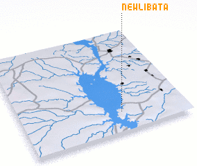 Places with similar names to New Libata, Nigeria ::
Disclaimer :: Information on this page comes without warranty of any kind |
||
|
Where is New Libata? Elevation and coordinates ::
Latitude (lat): 10°12'0"N Longitude (lon): 4°37'0"E
Elevation (approx.): 153m (map arrows pan, magnifying glasses zoom) |
||
|
Visiting New Libata? Hotel/Accommodation ::
Book a hotel in New Libata Travel Guide ::
Buy a travel guide for Nigeria rental cars ::
car rental offers GPS waypoint ::
download a GPX waypoint (PoI) of New Libata for your GPS receiver
|
||